Districts of Uthai Thani, Thailand |
| District | Population | Area(km.²) |
|---|---|---|
| Ban Rai | 59105 | 3622 |
| Huai Khot | 17256 | 424 |
| Lan Sak | 53611 | 1080 |
| Nong Chang | 43889 | 341 |
| Nong Khayang | 15712 | 348 |
| Sawang Arom | 28645 | 341 |
| Thap Than | 35896 | 324 |
| Uthai Thani | 50008 | 250 |

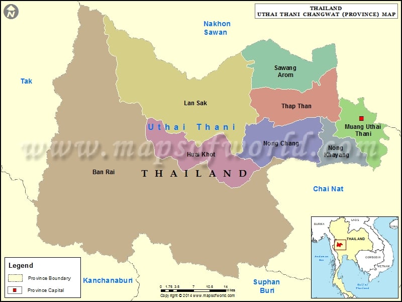
Description : Map showing the administrative divisions of the Uthai Thani Province, Thailand.
Districts of Uthai Thani, Thailand |
| District | Population | Area(km.²) |
|---|---|---|
| Ban Rai | 59105 | 3622 |
| Huai Khot | 17256 | 424 |
| Lan Sak | 53611 | 1080 |
| Nong Chang | 43889 | 341 |
| Nong Khayang | 15712 | 348 |
| Sawang Arom | 28645 | 341 |
| Thap Than | 35896 | 324 |
| Uthai Thani | 50008 | 250 |
This website uses cookies to improve your experience. We'll assume you're ok with this, but you can opt-out if you wish. Read More