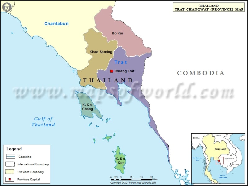
Districts of Trat, Thailand |
| District | Population | Area(km.²) |
|---|---|---|
| Bo Rai | 39736 | 680 |
| Khao Saming | 40499 | 679 |
| Khlong Yai | 25134 | 50 |
| Ko Chang | 4399 | 155 |
| Ko Kut | 2042 | 162 |
| Laem Ngop | 17874 | 154 |
| Trat | 89661 | 939 |

Description : Map showing the administrative divisions of the Trat Province, Thailand.
Districts of Trat, Thailand |
| District | Population | Area(km.²) |
|---|---|---|
| Bo Rai | 39736 | 680 |
| Khao Saming | 40499 | 679 |
| Khlong Yai | 25134 | 50 |
| Ko Chang | 4399 | 155 |
| Ko Kut | 2042 | 162 |
| Laem Ngop | 17874 | 154 |
| Trat | 89661 | 939 |
This website uses cookies to improve your experience. We'll assume you're ok with this, but you can opt-out if you wish. Read More