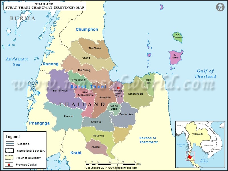
Description : Map showing the administrative divisions of the Surat Thani Province, Thailand.
Districts of Surat Thani, Thailand
|
|
| District |
Population |
Area(km.²) |
| Ban Na Doem |
20958 |
207 |
| Ban Na San |
66813 |
839 |
| Ban Ta Khun |
13519 |
1308 |
| Chai Buri |
18933 |
441 |
| Chaiya |
43630 |
1011 |
| Don Sak |
33436 |
461 |
| Kanchanadit |
90782 |
879 |
| Khian Sa |
36525 |
584 |
| Khiri Rat Nikhom |
37592 |
812 |
| Ko Pha-ngan |
9866 |
194 |
| Ko Samui |
34717 |
229 |
| Phanom |
29250 |
708 |
| Phrasaeng |
52956 |
950 |
| Phunphin |
90419 |
1209 |
| Surat Thani |
150954 |
234 |
| Tha Chana |
43884 |
687 |
| Tha Chang |
28961 |
1168 |
| Vibhavadi |
9877 |
544 |
| Wiang Sa |
56338 |
428 |

