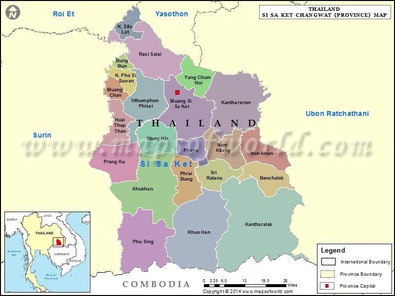
Description : Map showing the administrative divisions of the Si Sa Ket Province, Thailand.
Districts of Si Sa Ket, Thailand
|
|
| District |
Population |
Area(km.²) |
| Benchalak |
34639 |
331 |
| Bueng Bun |
10586 |
50 |
| Huai Thap Than |
38993 |
195 |
| Kantharalak |
189863 |
1237 |
| Kanthararom |
99178 |
664 |
| Khukhan |
141815 |
914 |
| Khun Han |
98843 |
723 |
| Mueang Chan |
17462 |
96 |
| Nam Kliang |
40680 |
258 |
| Non Khun |
36266 |
257 |
| Phayu |
37314 |
225 |
| Pho Si Suwan |
23289 |
111 |
| Phrai Bueng |
46360 |
249 |
| Phu Sing |
47138 |
940 |
| Prang Ku |
68305 |
285 |
| Rasi Salai |
80870 |
505 |
| Sila Lat |
20637 |
132 |
| Si Rattana |
50474 |
237 |
| Si Sa Ket |
133478 |
576 |
| Uthumphon Phisai |
108920 |
408 |
| Wang Hin |
44358 |
238 |
| Yang Chum Noi |
36032 |
210 |

