
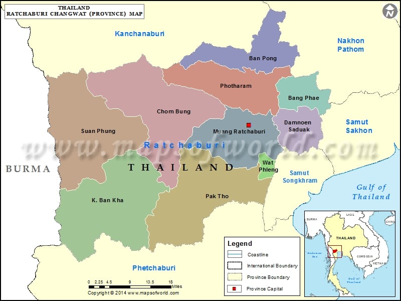
Districts of Ratchaburi, Thailand |
| District | Population | Area(km.²) |
|---|---|---|
| Bang Phae | 42949 | 173 |
| Ban Kha | 19354 | 1027 |
| Ban Pong | 157689 | 367 |
| Chom Bueng | 57070 | 772 |
| Damnoen Saduak | 98994 | 210 |
| Pak Tho | 61015 | 758 |
| Photharam | 128434 | 417 |
| Ratchaburi | 183528 | 430 |
| Suan Phueng | 30252 | 1005 |
| Wat Phleng | 11932 | 38 |