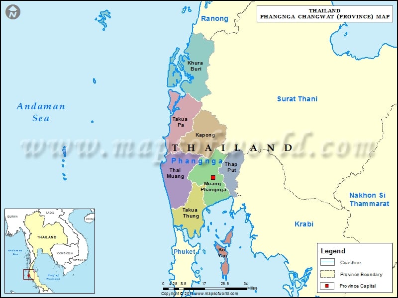
Districts of Phangnga, Thailand |
| District | Population | Area(km.²) |
|---|---|---|
| Kapong | 12692 | 589 |
| Khura Buri | 22011 | 797 |
| Ko Yao | 12548 | 141 |
| Mueang Phang Nga | 36747 | 550 |
| Takua Pa | 43459 | 599 |
| Takua Thung | 39597 | 611 |
| Thai Mueang | 43829 | 612 |
| Thap Put | 23305 | 272 |

Description : Map showing the administrative divisions of the Phangnga Province, Thailand.
Districts of Phangnga, Thailand |
| District | Population | Area(km.²) |
|---|---|---|
| Kapong | 12692 | 589 |
| Khura Buri | 22011 | 797 |
| Ko Yao | 12548 | 141 |
| Mueang Phang Nga | 36747 | 550 |
| Takua Pa | 43459 | 599 |
| Takua Thung | 39597 | 611 |
| Thai Mueang | 43829 | 612 |
| Thap Put | 23305 | 272 |
This website uses cookies to improve your experience. We'll assume you're ok with this, but you can opt-out if you wish. Read More