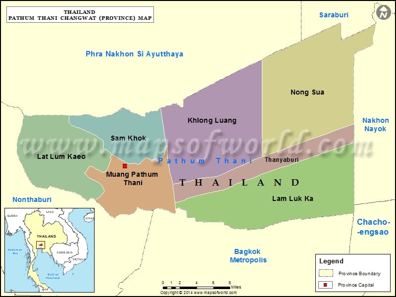
Districts of Pathum Thani, Thailand |
| District | Population | Area(km.²) |
|---|---|---|
| Khlong Luang | 150871 | 299 |
| Lam Luk Ka | 139456 | 298 |
| Lat Lum Kaeo | 43014 | 188 |
| Nong Suea | 46565 | 414 |
| Pathum Thani | 129649 | 120 |
| Sam Khok | 44712 | 95 |
| Thanyaburi | 123382 | 112 |

Description : Map showing the administrative divisions of the Pathum Thani Province, Thailand.
Districts of Pathum Thani, Thailand |
| District | Population | Area(km.²) |
|---|---|---|
| Khlong Luang | 150871 | 299 |
| Lam Luk Ka | 139456 | 298 |
| Lat Lum Kaeo | 43014 | 188 |
| Nong Suea | 46565 | 414 |
| Pathum Thani | 129649 | 120 |
| Sam Khok | 44712 | 95 |
| Thanyaburi | 123382 | 112 |
This website uses cookies to improve your experience. We'll assume you're ok with this, but you can opt-out if you wish. Read More