
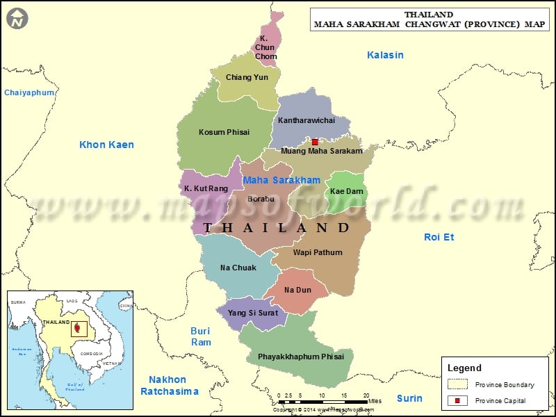
Districts of Maha Sarakham, Thailand |
| District | Population | Area(km.²) |
|---|---|---|
| Borabue | 109927 | 682 |
| Chiang Yuen | 63390 | 289 |
| Chuen Chom | 24386 | 113 |
| Kae Dam | 29555 | 150 |
| Kantharawichai | 75649 | 372 |
| Kosum Phisai | 122632 | 828 |
| Kut Rang | 36394 | 267 |
| Maha Sarakham | 148317 | 557 |
| Na Chueak | 61018 | 528 |
| Na Dun | 37411 | 248 |
| Phayakkhaphum Phisai | 87719 | 410 |
| Wapi Pathum | 115765 | 606 |
| Yang Sisurat | 35150 | 243 |