Districts of Krabi, Thailand |
| District | Population | Area(km.²) |
|---|---|---|
| Ao Luek | 44520 | 773 |
| Khao Phanom | 38740 | 789 |
| Khlong Thom | 55437 | 1043 |
| Ko Lanta | 23499 | 340 |
| Krabi | 79622 | 596 |
| Lam Thap | 17041 | 321 |
| Nuea Khlong | 47088 | 415 |
| Plai Phraya | 30263 | 433 |

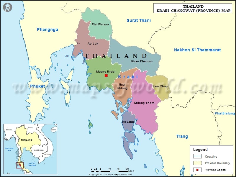
Description : Map showing the administrative divisions of the Krabi Province, Thailand.
Districts of Krabi, Thailand |
| District | Population | Area(km.²) |
|---|---|---|
| Ao Luek | 44520 | 773 |
| Khao Phanom | 38740 | 789 |
| Khlong Thom | 55437 | 1043 |
| Ko Lanta | 23499 | 340 |
| Krabi | 79622 | 596 |
| Lam Thap | 17041 | 321 |
| Nuea Khlong | 47088 | 415 |
| Plai Phraya | 30263 | 433 |
This website uses cookies to improve your experience. We'll assume you're ok with this, but you can opt-out if you wish. Read More