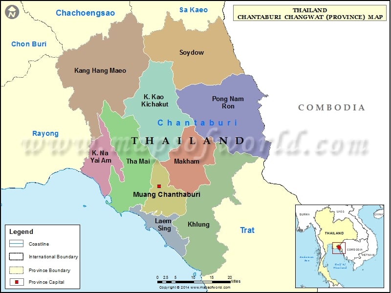
Districts of Chanthaburi, Thailand |
| District | Population | Area(km.²) |
|---|---|---|
| Chanthaburi | 124462 | 253 |
| Kaeng Hang Maeo | 34920 | 1254 |
| Khao Khitchakut | 24433 | 830 |
| Khlung | 54937 | 756 |
| Laem Sing | 31172 | 191 |
| Makham | 28341 | 480 |
| Na Yai Am | 31973 | 300 |
| Pong Nam Ron | 33376 | 927 |
| Soi Dao | 48256 | 734 |
| Tha Mai | 68194 | 613 |

