
Situated about 70 km north of the Swedish capital of Stockholm, Uppsala is the 4th largest city and the center of the local municipality. Well-known as the religious center of the nation, it houses the seat of the Swedish Archbishop since 1164.
Originally located a few kilometers away to the north, in a place called “Gamla (old) Uppsala”, the city was initially called “Ostra Aros”. According to the medieval author Adam of Bremen, Uppsala consists of the main heathen area of Sweden with the Temple of Uppsala erected nearby containing the deities of Aesir Gods.
At a later stage in the history of Uppsala, Christians replaced the Scandinavian gods. Soon, a bishop was appointed and the city was transformed into an Archdiocese with monks and other Christian saints to guide the population in the right track of life.
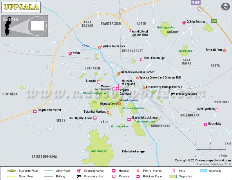
Situated on the fertile Uppsala plain lands, the city has numerous rivers like the Fyris flowing across the landscape surrounded by lush green vegetations. The glacial ridge of Uppsalaasen runs parallel to the to the river, at an altitude of 30 meters above sea levels.
Presently, the urban economy in Uppsala thrives on the medical researches in the field of biotechnology, as well as extensive agricultural activities on the fertile alluvial deposition from the rivers. The Uppsala University as well as the Swedish University of Agricultural Sciences facilitates higher education in the region. With a handful of popular tourist destinations like the Uppsala Cathedral and the Uppsala Castle, the city is gaining prominence very fast in the realm of travel and tourism industry on a global basis.