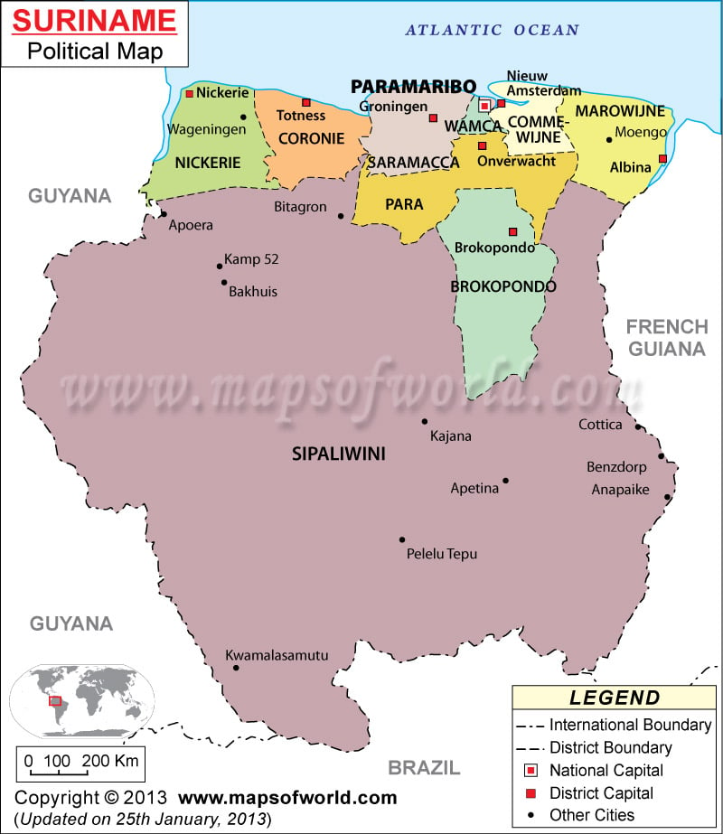
Location of Surinam
Surinam is a northern South American country that is located between Guyana in the west and French Guiana in the east. It borders the North Atlantic Ocean. Surinam lies on the latitude of 4° North and longitude of 56°West. The total area covered by this country is 163,270 sq km. Brazil is located to the south of Surinam.
Surinam Districts
The important districts into which Surinam is divided are shown on the Surinam Political Map. These include:
|
|
Paramaribo
Paramaribo is the capital city of Surinam and is located on the geographical coordinates of 5° 50′ North latitude and 55° 10′ West longitude. It is marked on the Surinam Political Map by a red square.
District Capitals
The district capitals are highlighted on the Printable Map of Surinam by white box. These capital cities are:
- Totness
- Nickeria
- Brokopondo
- Albina
- Onverwacht
- Groningen
- Amsterdam
Cities of Surinam
Some of the important cities of Surinam as shown on the Surinam Map by black dots are:
|
|
| District | Population | Area(km.²) | Area(mi.²) | Capital |
|---|---|---|---|---|
| Brokopondo | 14,215 | 7,364 | 2,843 | Brokopondo |
| Commewijne | 24,649 | 2,353 | 908 | Nieuw Amsterdam |
| Coronie | 2,887 | 3,902 | 1,507 | Totness |
| Marowijne | 16,642 | 4,627 | 1,786 | Albina |
| Nickerie | 36,639 | 5,353 | 2,067 | Nieuw Nickerie |
| Para | 18,749 | 5,393 | 2,082 | Onverwacht |
| Paramaribo | 242,946 | 182 | 70 | Paramaribo |
| Saramacca | 15,980 | 3,636 | 1,404 | Groningen |
| Sipaliwini | 34,136 | 130,567 | 50,412 | Paramaribo |
| Wanica | 85,986 | 443 | 171 | Lelydorp |
| 10 districts | 492,829 | 163,820 | 63,251 |

