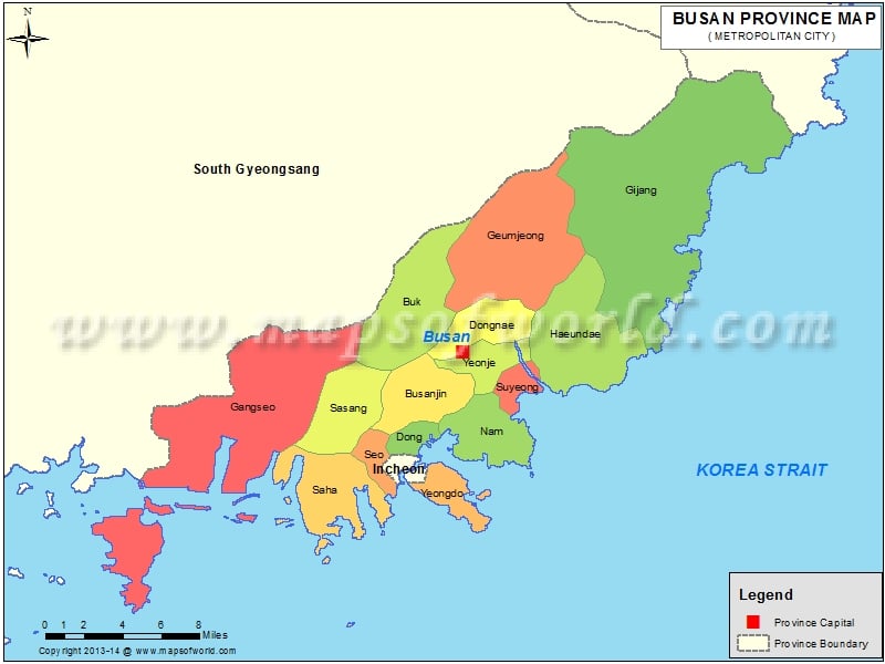
The Second largest city of South Korea, Busan has a population of of about 4 million people. The Korean City of Busan is also known as Pusan and it serves as the largest Port city.
The city of Busan is famous for its beaches and sea foods and it also serves as the main port for International cargo and passenger
ferry to the Islands of Japan and Jeju. Besides the sea, the city of Busan also has some beautiful mountains. This unique combination of Sea and Mountain makes Busan one of the major attractions of South Korea.
With the Sea being the major feature of the city of Busan, much of the transportation system is based on it. The Coastal Ferry Terminal is from where a number for ferry’s to locations like Geoje Island as well as to Jeju City in Jeju-do take off. There are also some International ferry services with the International Ferry Terminal on Busan Harbor as its station. Busan is also equipped with a number of rail lines, of which the most important is the Gyeongbu Line which connects Busan to other major cities such as Seoul, Daejeon, and Daegu. Operated by the Bus Transportation Corporation, Busan has has three lines of Subway Network.
With six beautiful beaches, Busan is a major tourist destination especially in summer. The beaches are adorned with colorful shops and carnival boardwalk. Cafes, bars, Restaurants line the beaches.Gwangbok-dong and Nampo-dong areas are part of Busan downtown and are famous for its cafes and Restaurants.

