
 Wall Maps
South Africa Political Map shows its 9 provinces, 3 national capitals and each province capital with political boundaries, it is also available for download.
South Africa Political Map
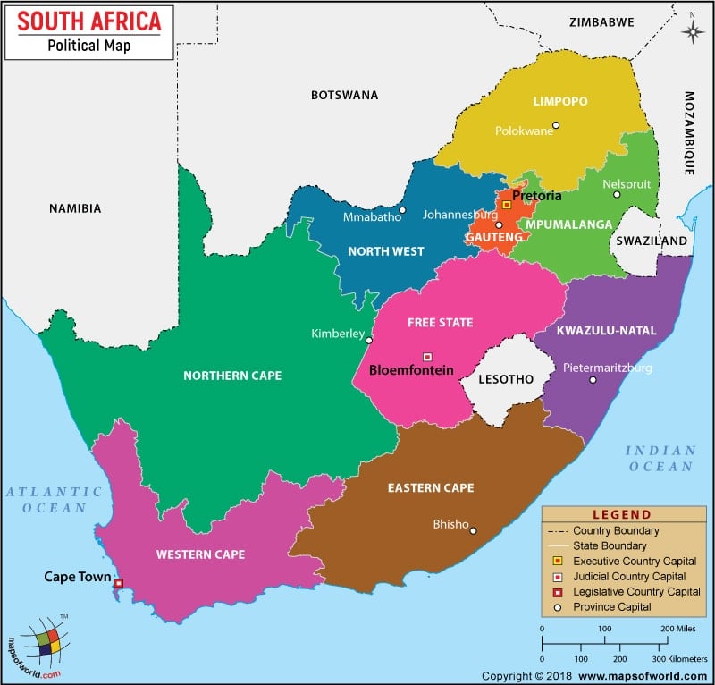
Description : This map shows the international boundary of South Africa, the boundaries of the provinces, along with their capitals and the national capital.
- South Africa Cities - Durban, Pretoria, Soweto, Cape Town
- South Africa Provinces - Eastern Cape, Free State, Gauteng, KwaZulu-Natal, Limpopo, Mpumalanga, North-West, Northern Cape, Western Cape
- Neighboring Countries - Lesotho, Swaziland, Botswana, Zimbabwe, Namibia
- Continent And Regions - Africa Map
- Other South Africa Maps - South Africa Map, Where is South Africa, South Africa Blank Map, South Africa Road Map, South Africa River Map, South Africa Physical MapSouth Africa Flag Map