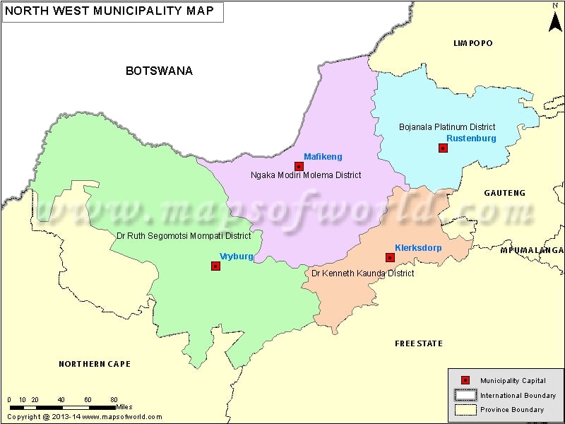
Description : North-West Map showing all the municipalities along with province boundary, municipality boundary with their capital city.
| S.N. |
District municipalities |
Code |
Seat |
Area (km²) |
Population (2011) |
| 1 |
Bojanala Platinum District Municipality |
DC37 |
Rustenburg |
18,333 |
1,507,505 |
| 2 |
Dr Kenneth Kaunda District Municipality |
DC40 |
Klerksdorp |
14,642 |
695,933 |
| 3 |
Dr Ruth Segomotsi Mompati District Municipality |
DC39 |
Vryburg |
44,017 |
463,815 |
| 4 |
Ngaka Modiri Molema District Municipality |
DC38 |
Mafikeng |
27,889 |
842,699 |
| S.N. |
Local municipalities |
Code |
Seat |
Area (km²) |
Population (2011) |
| 1 |
City of Matlosana Local Municipality |
NW403 |
Klerksdorp |
3,561 |
398,676 |
| 2 |
Ditsobotla Local Municipality |
NW384 |
Lichtenburg |
6,465 |
168,902 |
| 3 |
Greater Taung Local Municipality |
NW394 |
Taung |
5,635 |
177,642 |
| 4 |
Kagisano-Molopo Local Municipality |
NW397 |
Ganyesa |
23,827 |
105,789 |
| 5 |
Kgetlengrivier Local Municipality |
NW374 |
Koster |
3,973 |
51,049 |
| 6 |
Lekwa-Teemane Local Municipality |
NW396 |
Christiana |
3,681 |
53,248 |
| 7 |
Madibeng Local Municipality |
NW372 |
Brits |
3,839 |
477,381 |
| 8 |
Mafikeng Local Municipality |
NW383 |
Mafikeng |
3,698 |
291,527 |
| 9 |
Mamusa Local Municipality |
NW393 |
Schweizer-Reneke |
3,615 |
60,355 |
| 10 |
Maquassi Hills Local Municipality |
NW404 |
Wolmaransstad |
4,643 |
77,794 |
| 11 |
Moretele Local Municipality |
NW371 |
Makapanstad |
1,379 |
186,947 |
| 12 |
Moses Kotane Local Municipality |
NW375 |
Mogwase |
5,719 |
242,554 |
| 13 |
Naledi Local Municipality |
NW392 |
Vryburg |
6,941 |
66,781 |
| 14 |
Ramotshere Moiloa Local Municipality |
NW385 |
Zeerust |
7,193 |
150,713 |
| 15 |
Ratlou Local Municipality |
NW381 |
Setlagole |
4,884 |
107,339 |
| 16 |
Rustenburg Local Municipality |
NW373 |
Rustenburg |
3,423 |
549,575 |
| 17 |
Tlokwe Local Municipality |
NW402 |
Potchefstroom |
2,674 |
162,762 |
| 18 |
Tswaing Local Municipality |
NW382 |
Delareyville |
5,966 |
124,218 |
| 19 |
Ventersdorp Local Municipality |
NW401 |
Ventersdorp |
3,764 |
56,702 |

