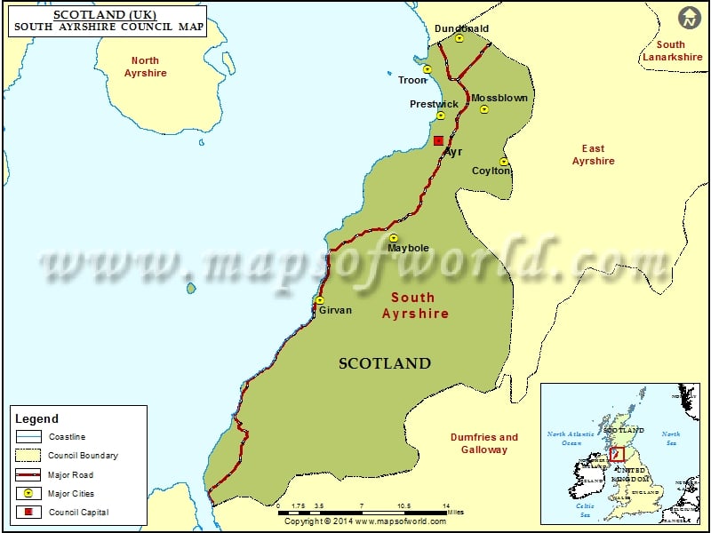
Lying on the southern part of Ayrshire in Scotland is the South Ayrshire Council, one of the 32 council areas of Scotland. This council area borders North Ayrshire, Dumfries and Galloway, and East Ayrshire. Formed in the year 1996, the administrative boundaries are said to be a successor to the district of Kyle and Carrick.
The administrative headquarters of the council, “County Buildings” is located in Wellington Square, Ayr. The council is spread over a total area of 472 square miles.
There is a conservative minority administration for South Ayrshire working in collaboration with the Labour Group. The Leader of the Council is Martin Dowey and its Provost is Lain Campbell. The elected councilors play an important role in the running of the South Ayrshire Council. They are entrusted with the responsibility of making policy decisions on various areas of Local Government services. They also stand as the representative of the South Ayrshire people in an array of trusts and bodies.
Some of the towns and villages of South Ayrshire Council areas are Barrhill, Drongan, Annbank, Ayr, Prestwick, Monkton, Girvan, Dunure, Alloway, Straiton, etc.
Cities in South Ayrshire Council |
|||
| Council | City | Latitude | Longitude |
|---|---|---|---|
| South Ayrshire | Girvan | 55.23 | -4.87 |
| South Ayrshire | Maybole | 55.33 | -4.7 |
| South Ayrshire | Coylton | 55.43 | -4.48 |
| South Ayrshire | Prestwick | 55.48 | -4.62 |
| South Ayrshire | Mossblown | 55.490686 | -4.529643 |
| South Ayrshire | Troon | 55.53 | -4.67 |
| South Ayrshire | Dundonald | 55.574276 | -4.591863 |

