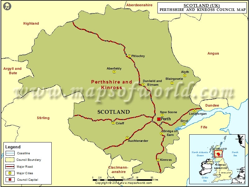
Cities in Perthshire and Kinross Council |
|||
| Council | City | Latitude | Longitude |
|---|---|---|---|
| Perthshire and Kinross | Kinross | 56.2 | -3.42 |
| Perthshire and Kinross | Auchterarder | 56.3 | -3.7 |
| Perthshire and Kinross | Bridge of Earn | 56.33 | -3.4 |
| Perthshire and Kinross | Crieff | 56.37 | -3.83 |
| Perthshire and Kinross | Errol | 56.38 | -3.2 |
| Perthshire and Kinross | New Scone | 56.42 | -3.4 |
| Perthshire and Kinross | Longforgan | 56.45 | -3.12 |
| Perthshire and Kinross | Dunkeld and Birnam | 56.564976 | -3.585584 |
| Perthshire and Kinross | Blairgowrie | 56.58 | -3.33 |
| Perthshire and Kinross | Alyth | 56.62 | -3.22 |
| Perthshire and Kinross | Aberfeldy | 56.62 | -3.85 |
| Perthshire and Kinross | Pitlochry | 56.7 | -3.72 |
Map of Perthshire and Kinross Council

Description : Map showing the major cities and roads of the Perthshire and Kinross Council, Scotland (UK).
