
Unlike the conventional method of displaying the world globe as a flat image, Robinson projection is the technique wherein the world map displays all the countries, continents, rivers, oceans etc. at once. Devised by Arthur Robinson in 1961, Robinson Projection allows users to gather a better overview of the countries of the world and their international borders.
World Map in Robinson Projection
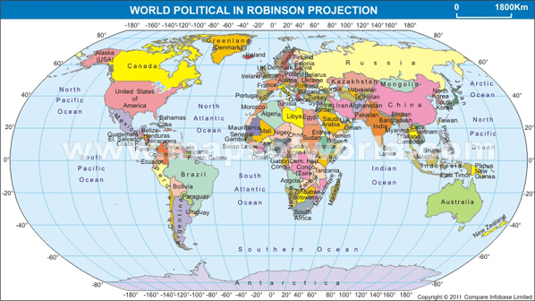
This map shows countries of the world in Robinson projection.