
Map of Slaskie Voivodeship or Silesia Province (in Polish: Wojewodztwa Slaskie), Poland illustrates all the counties along with Voivodeship boundary, county boundary with their capital city, and international boundary. Silencia Province borders Slovakia and the Czech Republic.
Slaskie Poland Map
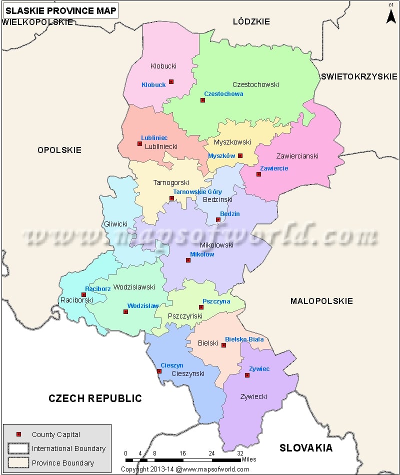
Description : Map of Slaskie Voivodeship, Poland (in Polish: Wojewodztwa Slaskie) showing all the counties along with Voivodeship boundary, county boundary with their capital city.