
Map of Mazowieckie Voivodeship or Masovia Province (in Polish: Wojewodztwa Mazowieckie), Poland illustrates all the counties along with Voivodeship boundary, county boundary with their capital city, and international boundary.
Mazowieckie Poland Map
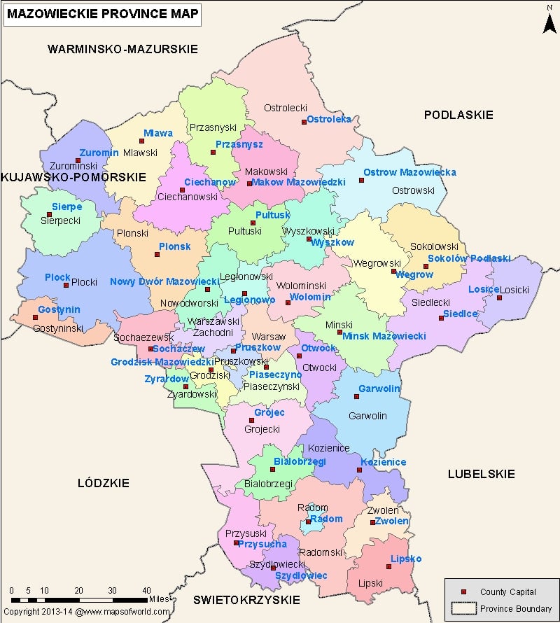
Description : Map of Mazowieckie Voivodeship, Poland (in Polish: Wojewodztwa Mazowieckie) showing all the counties along with Voivodeship boundary, county boundary with their capital city.