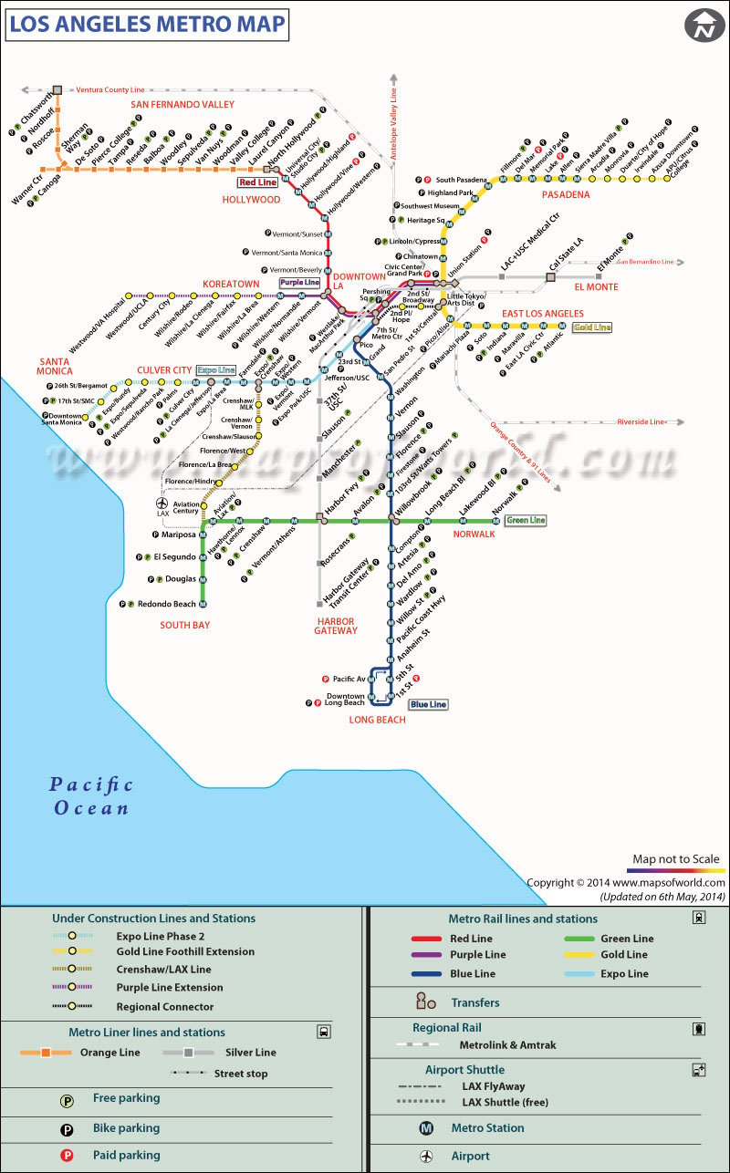
LA Metro Map showing the Metro network connectivity of Los Angeles hollywood city in the USA.
Six Metro Rail lines operate in Los Angeles
|
| Line name |
Opening Year |
Length in miles |
Stations |
Terminals |
Type |
| Blue Line |
1990 |
22 |
22 |
7th Street/Metro Center (north) Downtown Long Beach (south) |
Light rail |
| Expo Line |
2012 |
15.2 |
19 |
7th Street/Metro Center (east) Santa Monica (west) |
Light rail |
| Gold Line |
2003 |
31 |
27 |
APU/Citrus College (north) Atlantic (south) |
Light rail |
| Green Line |
1995 |
20 |
14 |
Redondo Beach (west) Norwalk (east) |
Light rail |
| Purple Line |
2006 |
6.4 |
8 |
Wilshire/Western (west) Union Station (east) |
Heavy rail |
| Red Line |
1993 |
16.4 |
14 |
North Hollywood (west) Union Station (east) |
Heavy rail |
