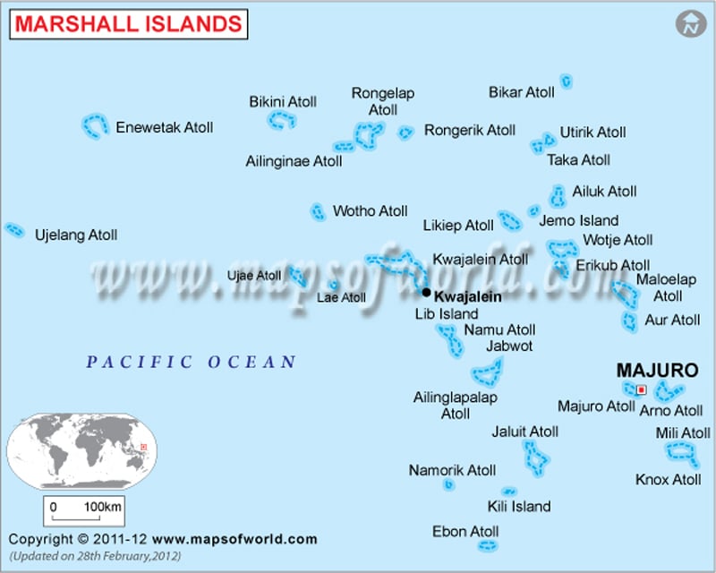
Political map of Marshall Islands illustrates the surrounding countries with international borders, 33 municipalities boundaries with their capitals and the national capital.

Description : Marshall Islands Political map showing the international boundary, municipalities boundaries with their capitals and national capital.
Political map of Marshall Islands illustrates the surrounding countries with international borders, 33 municipalities boundaries with their capitals and the national capital.
This website uses cookies to improve your experience. We'll assume you're ok with this, but you can opt-out if you wish. Read More