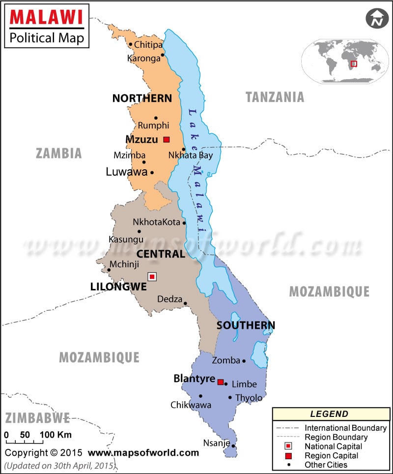
Malawi political map is the visual description of the country. The country is landlocked and is a neighbor to Mozambique, Tanzania and Zambia. The international boundary is marked with a dotted broken line on the political map of Malawi.
The Malawi map also features its province boundaries, which are drawn with the help of a broken line differentiating from each other. The black dots on the map of Malawi point the important cities of the country.
Location and Geography
Malawi’s geographical coordinates are 13°30′ South latitude and 34° East longitude. Malawi is located in the southern part of Africa. The country stands on a total area of 118, 480 square kilometers, of which 94,080 square kilometers is covered by land while 24,400 square kilometers is covered by water bodies.
Malawi has no coastline and is surrounded by land bodies from all sides. Sapitwa at 3,002 meters is the highest point of the country while the Shire River and the international boundary with Mozambique is the lowest point.
Malawi Provinces
Browsers can easily point out the provinces on the printable map of Malawi. The names of the provinces feature in bold types and are distinctly colored for the convenience of the browsers. The names of the provinces and their capitals are listed below:
- Northern- Mzuzu
- Central- Lilongwe
- Southern- Blantyre
Capital of Malawi
Lilongwe situated at an altitude of 1024 meters above sea level is the capital of Malawi. The capital is marked with a red dot on the online Malawi map. The latitudinal and longitudinal extent of the city is 13°58’60” South and 33°46’60” East respectively. The nearby cities and towns are:
- Kumlira
- Thope
- Chilinde
- Kawali
- Mwenda
The city also houses four airports, which serve as gateways to the capital city. They are Lilongwe, Lilongwe International, kasungu and Ulongwe.
Locations in the Map
MAJOR REGION AND THEIR CAPITAL
Northern, Central, Southern, Mzuzu, Lilongwe, Blatyre.
NATIONAL CAPITAL LILONGWE.
OTHER MAJOR CITIES
Chitipa, Karonga, Rumphi, Mzimba, Luwawa, Nkhata Bay, Mkhota, Kota, Kasungu, Mchinji, Dedza, Zomba, Limbe, Chiwawa, Thyolo, Mulanje, Nsanje.
NEIGHBOUR COUNTRIES/ISLANDS Mozambique, Zambia, Tanzania.
| District | Population | Area(km.²) | Area(mi.²) |
|---|---|---|---|
| Balaka | 316,748 | 2,193 | 847 |
| Blantyre | 999,491 | 2,012 | 777 |
| Chikwawa | 438,895 | 4,755 | 1,836 |
| Chiradzulu | 290,946 | 767 | 296 |
| Chitipa | 179,072 | 4,288 | 1,656 |
| Dedza | 623,789 | 3,624 | 1,399 |
| Dowa | 556,678 | 3,041 | 1,174 |
| Karonga | 272,789 | 3,355 | 1,295 |
| Kasungu | 616,085 | 7,878 | 3,042 |
| Likoma | 10,445 | 18 | 7 |
| Lilongwe | 1,897,167 | 6,159 | 2,378 |
| Machinga | 488,996 | 3,771 | 1,456 |
| Mangochi | 803,602 | 6,273 | 2,422 |
| Mchinji | 456,558 | 3,356 | 1,296 |
| Mulanje | 525,429 | 2,056 | 794 |
| Mwanza | 94,476 | 826 | 319 |
| Mzimba | 853,305 | 10,430 | 4,027 |
| Neno | 108,897 | 1,469 | 567 |
| Nkhata Bay | 213,779 | 4,071 | 1,572 |
| Nkhotakota | 301,868 | 4,259 | 1,644 |
| Nsanje | 238,089 | 1,942 | 750 |
| Ntcheu | 474,464 | 3,424 | 1,322 |
| Ntchisi | 224,098 | 1,655 | 639 |
| Phalombe | 313,227 | 1,394 | 538 |
| Rumphi | 169,112 | 4,769 | 1,841 |
| Salima | 340,327 | 2,196 | 848 |
| Thyolo | 587,455 | 1,715 | 662 |
| Zomba | 670,533 | 2,580 | 996 |
| 28 districts | 13,066,320 | 94,276 | 36,400 |

