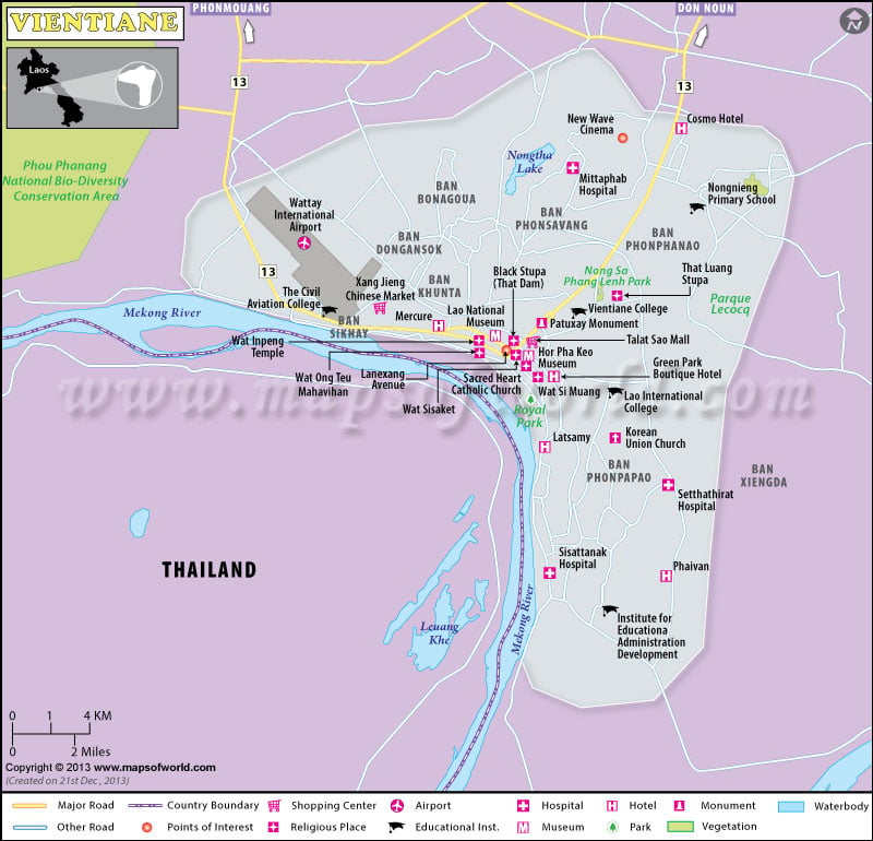
Vientiane, the Capital of Laos is divided into units such as provinces, prefectures and city. This early river-valley fiefdom is located on a bend in the Mekong River.
Because of the fertile alluvial plain the settlers chose this place. A fragile sovereignty was enjoyed by Vientiane in its early days.
Capital of Laos was controlled by Burmese, Siamese, Vietnamese and Khmer at different point of time. In the 14th century Lan Xang kingdom was established by the Khmer. Originally it was centered in Muang Sawa but the capital was moved to Vientiane in the 16th century. It was named the capital in the late 19th and early 20th century when the country became a French protectorate.
Laos’s capital is actually pronounced “Wieng Chan”. Wieng means “city or place with walls’ in Lao and Chan means either ‘sandalwood or moon”. Therefore Vientiane is known as Sandalwood City or Moon City.The image of exotic Eurasian setting can be found here, which is one of the three classic Indochinese cities. These images are the integrated part of the city. Thai, Chinese, Vietnamese, French, US, soviet influences all are at work in Vientiane.
Vientiane is the largest city of Laos but it is not tough to get to know this small city. The older section of the town along the Mekong river is really attractive with is living history. Passing traffic can not overshadow the atmosphere of timelessness that is generated by the tree-lined boulevards and old temples. Vientiane is also the place where you can experience the vibrant culture of Laos.

