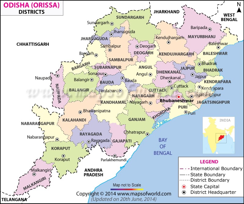
List of Odisha Districts |
|---|
| Code | District | Population (2011) | Area (sq km) |
|---|---|---|---|
| AN | Anugul | 1,273,821 | 6,375 |
| BD | Boudh (Baudh) | 441,162 | 3,098 |
| BH | Bhadrak | 1,506,337 | 2,505 |
| BL | Balangir | 1,648,997 | 6,575 |
| BR | Bargarh (Baragarh) | 1,481,255 | 5,837 |
| BW | Balasore (Baleswar) | 2,320,529 | 3,806 |
| CU | Cuttack | 2,624,470 | 3,932 |
| DE | Debagarh (Deogarh) | 312,520 | 2,940 |
| DH | Dhenkanal | 1,192,811 | 4,452 |
| GN | Ganjam | 3,529,031 | 8,206 |
| GP | Gajapati | 577,817 | 4,325 |
| JH | Jharsuguda | 579,505 | 2,114 |
| JP | Jajapur (Jajpur) | 1,827,192 | 2,899 |
| JS | Jagatsinghapur | 1,136,971 | 1,668 |
| KH | Khordha | 2,251,673 | 2,813 |
| KJ | Kendujhar (Keonjhar) | 1,801,733 | 8,303 |
| KL | Kalahandi | 1,576,869 | 7,920 |
| KN | Kandhamal | 733,110 | 8,021 |
| KO | Koraput | 1,379,647 | 8,807 |
| KP | Kendrapara | 1,440,361 | 2,644 |
| ML | Malkangiri | 613,192 | 5,791 |
| MY | Mayurbhanj | 2,519,738 | 10,418 |
| NB | Nabarangpur | 1,220,946 | 5,291 |
| NU | Nuapada | 610,382 | 3,852 |
| NY | Nayagarh | 962,789 | 3,890 |
| PU | Puri | 1,698,730 | 3,479 |
| RA | Rayagada | 967,911 | 7,073 |
| SA | Sambalpur | 1,041,099 | 6,624 |
| SO | Subarnapur (Sonepur) | 610,183 | 2,337 |
| SU | Sundargarh (Sundargarh) | 2,093,437 | 9,712 |

