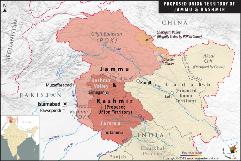
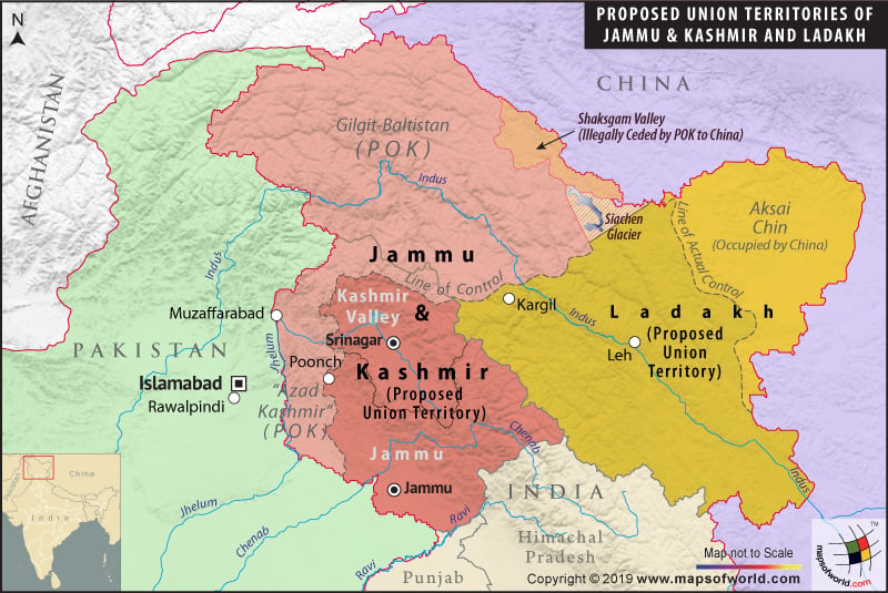
Map of New Union Territory of Ladakh (Proposed)

| Description :The Map showing all the districts in the state J&K, state capital, district HQ and district boundaries. |
Map of New Union Territory of Jammu and Kashmir (Proposed)

| Description :The Map showing all the districts in the state J&K, state capital, district HQ and district boundaries. |
Jammu and Kashmir Map
| Description :The Map showing all the districts in the state J&K, state capital, district HQ and district boundaries. |
List of Jammu division |
|---|
| Name of District | Headquarters | Area (km²) | Population (2011 Census) |
|---|---|---|---|
| Doda District | Doda | 2,306 | 409,576 |
| Jammu District | Jammu | 3,097 | 1,526,406 |
| Kathua District | Kathua | 2,651 | 615,711 |
| Kishtwar District | Kishtwar | 7,737 | 231,037 |
| Poonch District | Poonch | 1,674 | 476,820 |
| Rajouri District | Rajouri | 2,630 | 619,266 |
| Ramban District | Ramban | 1,329 | 283,313 |
| Reasi District | Reasi | 1,719 | 314,714 |
| Samba District | Samba | 904 | 318,611 |
| Udhampur District | Udhampur | 4,550 | 555,357 |
| Total | 26,293 | 5,350,811 |
List of Kashmir valley division |
|---|
| Name of District | Headquarters | Area (km²) | Population (2011 Census) |
|---|---|---|---|
| Anantnag District | Anantnag | 3,984 | 1,069,749 |
| Bandipora District | Bandipora | 398 | 385,099 |
| Baramulla district | Baramulla | 4,588 | 1,015,503 |
| Budgam District | Budgam | 1,371 | 755,331 |
| Ganderbal District | Ganderbal | 259 | 297,003 |
| Kulgam District | Kulgam | 1,067 | 423,181 |
| Kupwara District | Kupwara | 2,379 | 875,564 |
| Pulwama District | Pulwama | 1,398 | 570,060 |
| Shopian District | Shopian | 613 | 265,960 |
| Srinagar District | Srinagar | 2,228 | 1,250,173 |
| Total | 15,948 | 6,907,623 |
List of Ladakh division |
|---|
| Name of District | Headquarters | Area (km²) | Population (2011 Census) |
|---|---|---|---|
| Kargil District | Kargil | 14,036 | 143,388 |
| Leh District | Leh | 45,110 | 147,104 |
| Total | 59,146 | 290,492 |

