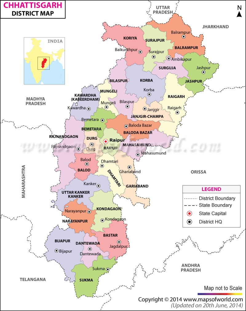
List of Chhattisgarh Districts |
|---|
| Code | District | Headquarters | Population (2011) | Area (sq km) |
|---|---|---|---|---|
| Balod | Balod | – | – | |
| Baloda Bazar | Baloda Bazar | – | – | |
| Balrampur-Ramanujgang | Balrampur | – | 3,806 | |
| BA | Bastar | Jagdalpur | 1,302,253 | 14,968 |
| Bemetara | Bemetara | – | – | |
| Bijapur | Bijapur | 229,832 | 6,555 | |
| BI | Bilaspur | Bilaspur | 1,993,042 | 8,270 |
| DA | Dantewada | Dantewada | 719,065 | 17,538 |
| DH | Dhamtari | Dhamtari | 703,569 | 3,383 |
| DU | Durg | Durg | 2,801,757 | 8,542 |
| Gariaband | Gariaband | – | – | |
| JA | Jashpur | Jashpur | 739,780 | 5,825 |
| JC | Janjgir-Champa | Naila Janjgir | 1,316,140 | 3,848 |
| Kondagaon | Kondagaon | – | – | |
| KB | Korba | Korba | 1,012,121 | 6,615 |
| KJ | Koriya | Baikunthpur | 585,455 | 6,578 |
| KK | Kanker | Kanker | 651,333 | 6,513 |
| KW | Kabirdham | Kawardha | 584,667 | 4,237 |
| MA | Mahasamund | Mahasamund | 860,176 | 4,779 |
| Mungeli | Mungeli | – | – | |
| Narayanpur | Narayanpur | 110,800 | 6,640 | |
| RG | Raigarh | Raigarh | 1,265,084 | 7,068 |
| RN | Rajnandgaon | Rajnandgaon | 1,281,811 | 8,062 |
| RP | Raipur | Raipur | 3,009,042 | 13,083 |
| SJ | Surajpur | Surajpur | 2,570,867 | 15,765 |
| SK | Sukma | Sukma | 2,49,000 | ——- |
| SU | Surguja | Ambikapur | 1,970,661 | 15,765 |

