Facts About Haiti |
|---|
| Country Name | Haiti |
|---|---|
| Continent | North America |
| Capital and largest city of Haiti | Port-au-Prince |
| Area | 27,750 km2 ( 10,714 sq mi ) Water (%) 0.7 |
| Population | 11.6 million estimate |
| Lat Long of Haiti | 19.255623, -72.436098 |
| Official Language | French, Haitian Creole |
| Calling Code | +509 |
| Time Zone | EST (UTC−5) Summer (DST) EDT (UTC−4) |
| Airports in Haiti | Total 17 Airport, 6- scheduled service |
| Neighbor countries | Dominican Republic |
| Internet TLD | .ht .gouv.ht .edu.ht |
| Currency | Haitian gourde (G) (HTG) |
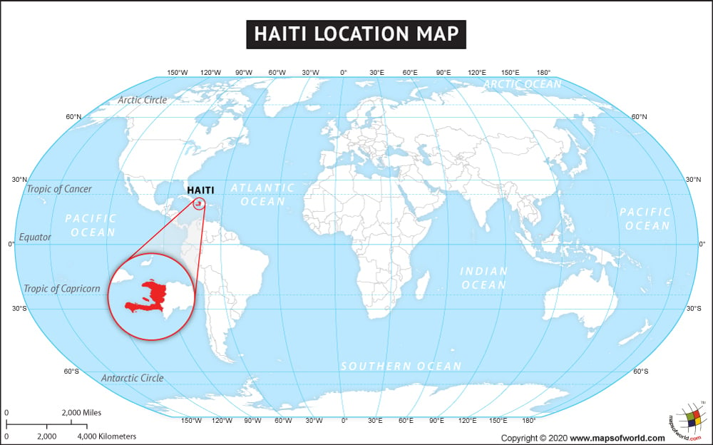
Where is Haiti
Haiti is situated in North America. Located in the Western Hemisphere, the sovereign state is spread over an area of 27,750 square kilometers. The nation is situated on the island of Hispaniola in the Caribbean’s Greater Antilles archipelago. Haiti is the third largest country in the Caribbean followed by Cuba and the Dominican Republic. To the east, the Dominican Republic borders Haiti. Cuba is located some 80 km west of the northern Peninsula of Haiti, while Jamaica is some 193 km west of the southern Peninsula. The nation has a coastline of 1,771 km. Haiti mostly has rough and mountainous terrain. The Caribbean Sea at 0 m is the lowest point of the country, while Chaine de la Selle at 2,680 m is the highest point.

