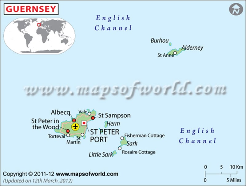
| Parish | Population | Area(km.²) | Area(mi.²) |
|---|---|---|---|
| Alderney | 2,294 | 8 | 3 |
| Brecqhou | 1 | 0 | |
| Castel | 8,975 | 10 | 4 |
| Forest | 1,549 | 4 | 2 |
| Herm | 95 | 1 | 1 |
| Jethou | 2 | 0 | 0 |
| Lihou | 0 | 0 | |
| Saint Andrew | 2,409 | 5 | 2 |
| Saint Martin | 6,267 | 7 | 3 |
| Saint Peter Port | 16,488 | 7 | 3 |
| Saint Pierre du Bois | 2,188 | 6 | 2 |
| Saint Sampson | 8,592 | 6 | 2 |
| Saint Saviour | 2,696 | 6 | 2 |
| Sark | 600 | 5 | 2 |
| Torteval | 973 | 3 | 1 |
| Vale | 9,573 | 9 | 3 |
| 16 divisions | 60,407 | 78 | 30 |
Note : – Population: 2001-04-29 census (Sark is an estimate)

