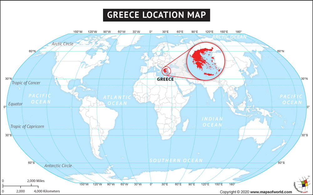
Greece, officially called Hellenic Greece is located in the southern part of Europe. This country has a strategic geopolitical location between Europe, Africa, and Western Asia. Greece due to its location to the west of the Aegean Sea dominates the Sea and the southern route to the Turkish Strait. Greece a peninsular country is bordered by the Ionian Sea in the west, the Mediterranean Sea in the south, and the Aegean Sea to its east. Its land boundary is shared with Bulgaria in the north, Albania in the northwest, the Republic of Macedonia in the north, and Turkey in the northeast. The total area covered by Greece is 131,957 sq km, making it the ninety-seventh largest country in the world. Greece also possesses an archipelago of 2000 islands.
Greece has a long coastline extending for about 13, 676 km long, its longest coastline is on the Mediterranean Sea, with many beautiful beaches on its side. The geographical coordinates of Greece are 31 00N and 22 00 E. Beautiful Athens is its largest and capital city.
Facts About Greece |
|---|
| Country Name | Greece |
|---|---|
| Continent | Europe |
| Capital and largest city | Athens |
| Area | 131,957 km2 (50,949 sq mi ) Water (%) 0.8669 |
| Population | 10.6 million estimate |
| Lat Long of Greece | 31° 0′ 0″ N, 22° 0′ 0″ E (31, 22) |
| Official Language | Greek |
| Calling Code | +30 |
| Time Zone | EET (UTC+2) Summer (DST) EEST (UTC+3) |
| Airports in Greece | 46 Airports in Greece |
| Neighbor countries | Turkey, Albania, Bulgaria, Macedonia (FYROM) |
| Internet TLD | .gr |
| Currency | Euro |

