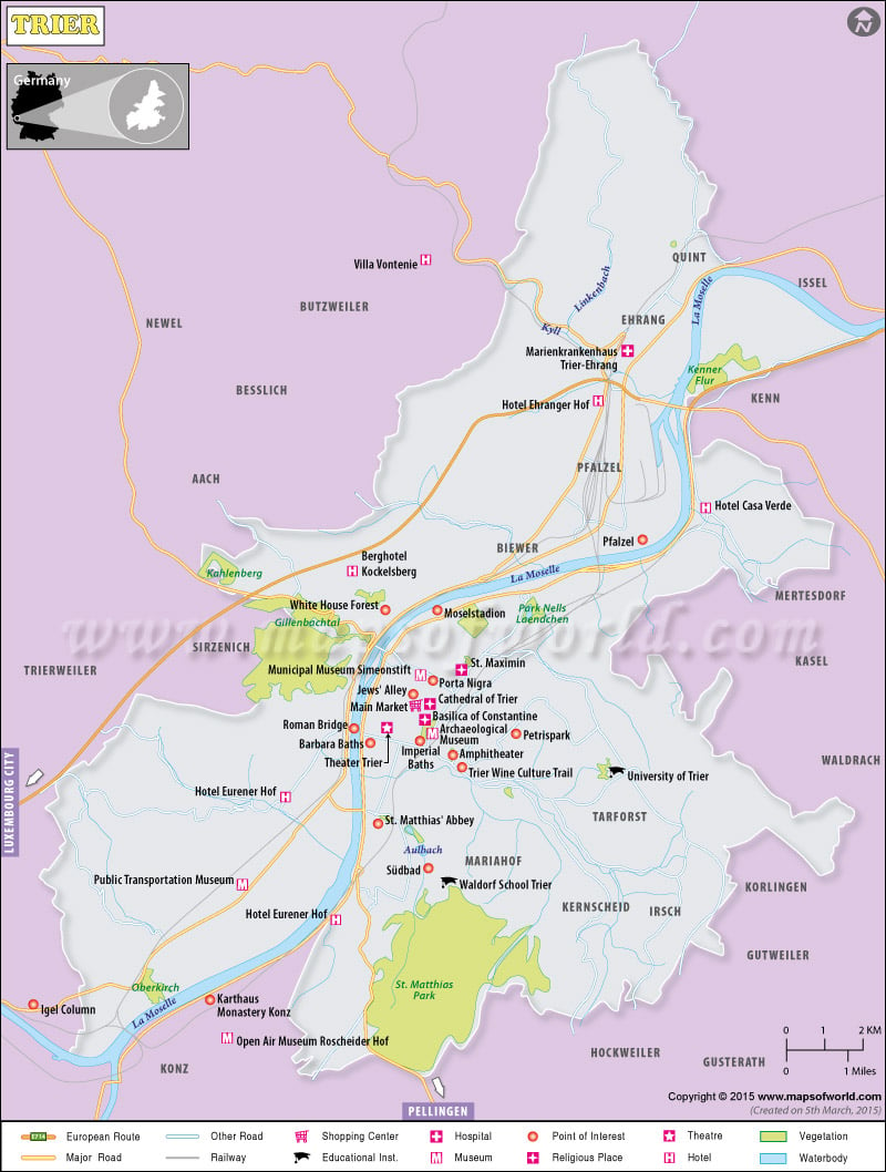
Description : Trier map showing railways, roads, shopping centers, tourist places, hotels, etc.
Trier Attractions
|
| Burg Eltz Munstermaifeld Germany |
| Porta Nigra Simeonstraße Trier Germany |
| Trierer Dom Domfreihof Trier Germany |
| Aula Palatina Konstantinstraße Trier Germany |
| Karl Marx House Johannisstraße Trier Germany |
| Liebfrauenkirche Liebfrauenstraße Trier Germany |
| Rheinisches Landesmuseum Weimarer Allee Trier Germany |
| St. Paulin-Kirche Thebaerstraße Trier Germany |
| Trier Amphitheater Trier Germany |
| Grain Market Am Kornmarkt 1- Trier Germany |
| Gangolfstraße Trier Germany |
| Museum am Dom Trier Bischof-Stein-Platz Trier Germany |
Organization of City Districts :
The Trier urban area is divided into 19 city districts.
| Official District Number |
District with associated sub-districts |
Area in km2 |
Inhabitants |
| 11 |
Mitte/Gartenfeld |
2.978 |
11954 |
| 12 |
Nord (Nells Ländchen, Maximin) |
3.769 |
13405 |
| 13 |
Süd (St. Barbara, St. Matthias or St. Mattheis) |
1.722 |
9123 |
| 21 |
Ehrang/Quint |
26.134 |
9195 |
| 22 |
Pfalzel |
2.350 |
3514 |
| 23 |
Biewer |
5.186 |
1949 |
| 24 |
Ruwer/Eitelsbach |
9.167 |
3091 |
| 31 |
West/Pallien |
8.488 |
7005 |
| 32 |
Euren (Herresthal) |
13.189 |
4207 |
| 33 |
Zewen (Oberkirch) |
7.496 |
3634 |
| 41 |
Olewig |
3.100 |
3135 |
| 42 |
Kürenz (Alt-Kürenz, Neu-Kürenz) |
5.825 |
8708 |
| 43 |
Tarforst |
4.184 |
6605 |
| 44 |
Filsch |
1.601 |
761 |
| 45 |
Irsch |
4.082 |
2351 |
| 46 |
Kernscheid |
3.768 |
958 |
| 51 |
Feyen/Weismark |
5.095 |
5689 |
| 52 |
Heiligkreuz (Alt-Heiligkreuz, Neu-Heiligkreuz, St. Maternus) |
2.036 |
6672 |
| 53 |
Mariahof (St. Michael) |
7.040 |
3120 |
|
Totals |
117.210 |
105076 |

