
LANGUEDOC – ROUSSILLON
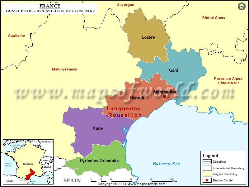
The capital of Languedoc – Roussillon region is Montpellier. The departments of the region include Aude, Gard, Herault, Lozere, Pyrenees – Orientales. Languedoc – Roussillon is divided into 14 arrondissements, 186 cantons and 1,545. It shares its borders with Spain, Andorra and the Mediterranean Sea. The total area covered by this region is around 27,300 km2.
GEOGRAPHY OF LANGUEDOC – ROUSSILLON
Languedoc – Roussillon is made up of a number of provinces. Around 68.7 % of the region is made up of the province of Languedoc. 17.9% of the region is made up of the province of Gevaudan. The remaining 13.4% of the region is made up of culturally Catalan pays.
POLITICS OF LANGUEDOC – ROUSSILLON
At present, the regional President of the region is Georges Freche. Freche has embarked on a complete overhaul of the region. The flag of Languedoc – Roussillon was also changed. The new flag has no reference to the old provinces. The President of Languedoc – Roussillon also wanted to change the name of the region to remove the duality and bring about uniformity.
The Romans had created the name Septimania. This name was used in the early Middle Ages. This name would have helped in removed the difference between the Occitan and Catalan speaking areas of this region. But this name has not been in use since the 9th century.
The population of the region opposed the use of the name and so gradually the use of the name was gradually cut off.