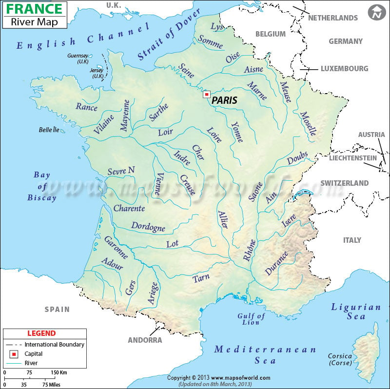
Locations in the Map
NATIONAL CAPITAL – PARIS
MAJOR CITIES of FRANCE
Brest, Lorient, Rennes, Nazaire Nantes, Angers, Le Mans, Orleans, Rouen, Cherbourg, Le Havre, Dieppe, Amiens, Reimes, Lille Calais, Meltz, Nancy, Strasbourg, Dijon, Troyes, Orelands, Lemans, Tours, Poitiers, La Rochelle, Angouleme, Limoges, Angouleme, Bordeaux, Bayonne, Pau, Toulouse, Montpellier, Nimes, Carcassonne, Perpignan, Marseille, Nice, St. Etienne, Lyon, Bastia, Ajaccia.
NEIGHBOUR COUNTRIES
The United Kingdom, Belgium, Luxembourg, Germany, Switzerland, Italy, Monaco, and Spain.
OCEANS, SEAS, RIVERS, BAYS, AND CANALS
Mediterranean Sea, Ligurian Sea, Bay of Biscay, Atlantic Ocean, English Channel, North Sea.
France |
|---|
| River | Length (km) | Length (miles) | Drainage area (km²) | Outflow | Countries in the drainage basin | France Regions in the drainage basin |
|---|---|---|---|---|---|---|
| Loire River | 1,010 | 627 | 117,054 | Bay of Biscay | France | Rhône-Alpes, Bourgogne, Centre, Pays de la Loire, Auvergne |
| Seine River | 770 | 478 | 78,650 | English Channel | France, Belgium | Burgundy |
| Rhone River | 812 | 505 | 98,000 | Mediterranean Sea | France, Switzerland | Provence-Alpes-Côte d’Azur, Languedoc-Roussillo, |
| Garonne River | 602 | 374 | 84,811 | Atlantic Ocean | France, Spain | Midi-Pyrénées,Aquitaine |
| Marne River | 514 | 319 | 12,800 | Confluence with Seine | France | Champagne-Ardenne, Ile-de-France |
| Dardogne River | 483 | 300 | 23,870 | Confluence with Garonne River | France | Limousin, Aquitaine |
| Charente River | 381 | 237 | 10,000 | Atlantic Ocean | France | Poitou-Charentes, Limousin |
| Tarn River | 381 | 237 | 15,700 | Confluence with Garonne River | France | Languedoc-Roussillon and Midi-Pyrénées |

