
East Riding of Yorkshire County Map – East Riding of Yorkshire is a ceremonial county and a local government district of England. Map of East Riding of Yorkshire shows the administrative divisions, county boundary, and county capital.
East Riding of Yorkshire County Map
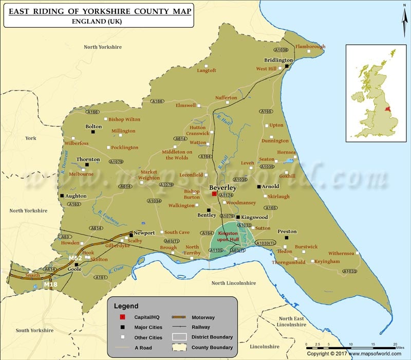
Description : Map showing the administrative divisions of the East Riding of Yorkshire county, England, United Kingdom.