
Dorset is a county in South West England. The map of Dorset shows the administrative divisions, county boundary, and county capital.
Dorset County Map
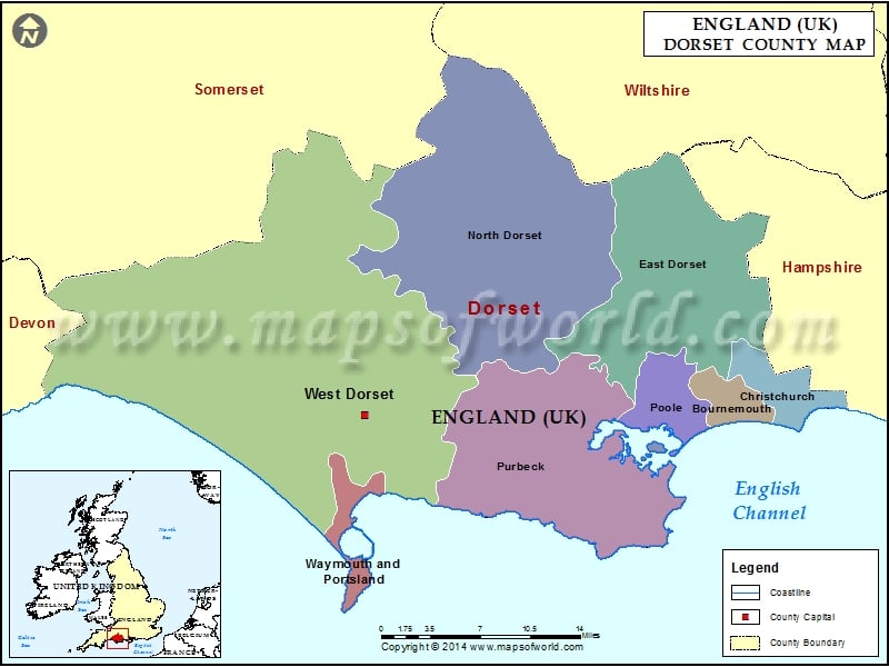
Description : Map showing the administrative divisions of the Dorset county, England, United Kingdom.