
Canada is a country in North America. Its ten provinces and three territories cover a land area of more than 9.98 million sq km making it the second largest country in the world by total area. Canada’s land area map shows how the land areas of Canada are covered.
Land Cover of Map Canada
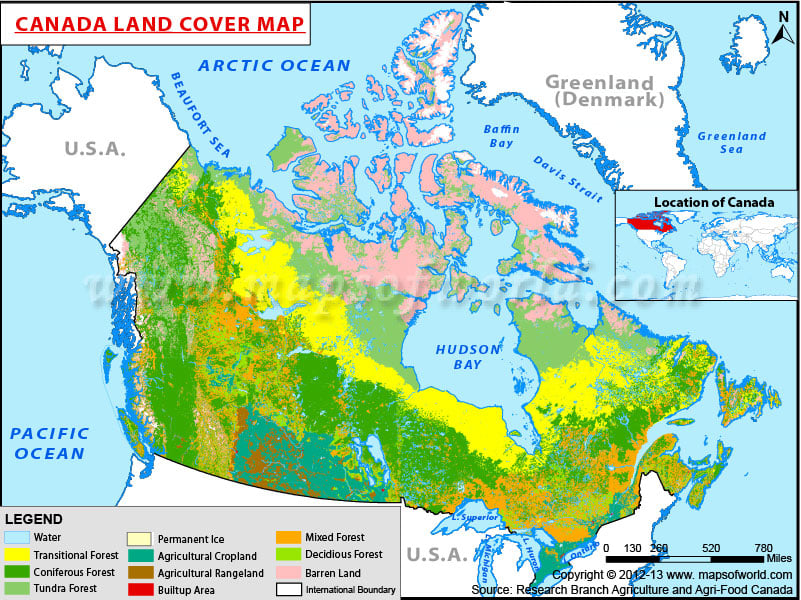
Description : Canada land area map shows the how the land of Canada is covered.