
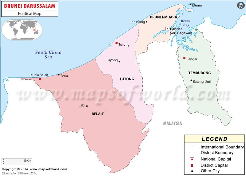
| Division | Population : 2010 estimate. | Area(km.²) | Area(mi.²) | Capital |
|---|---|---|---|---|
| Belait | 68,300 | 2,725 | 1,052 | Kuala Belait |
| Brunei and Muara | 290,100 | 570 | 220 | Bandar Seri Begawan |
| Temburong | 10,200 | 1,166 | 450 | Bangar |
| Tutong | 45,800 | 1,303 | 503 | Tutong |
| 4 divisions | 414,400 | 5,765 | 2,226 |
Population history: |
||
|---|---|---|
| Division | 8/21/2001 | 2010 (est.) |
| Belait | 55,602 | 68,300 |
| Brunei and Muara | 230,030 | 290,100 |
| Temburong | 8,563 | 10,200 |
| Tutong | 38,649 | 45,800 |
| 4 divisions | 332,844 | 414,400 |