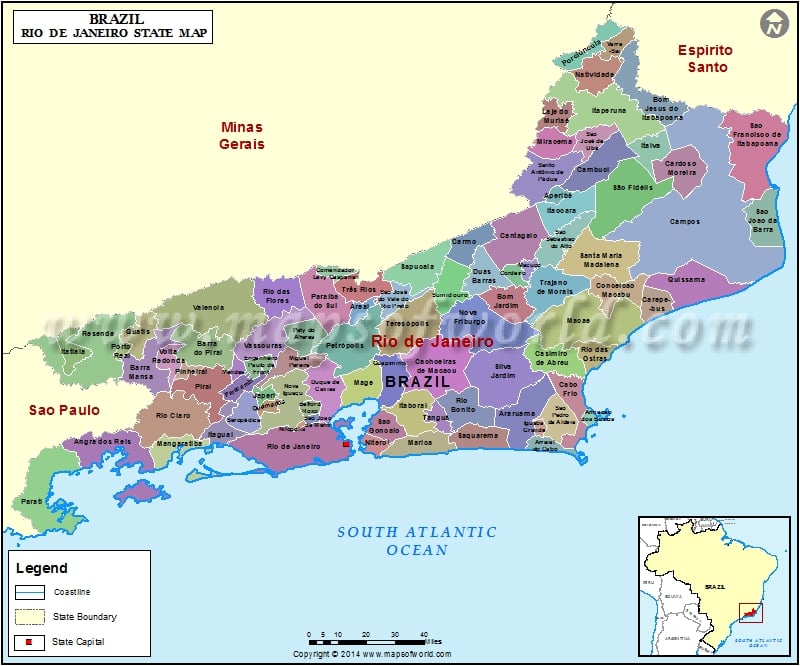
Facts about Rio de Janeiro State of Brazil |
|
|---|---|
| Country | Brazil |
| Capital | Rio de Janeiro |
| Area | 43,696.1 sq km |
| Population | 16,231,365 (Census 2012) |
| Demonym | Fluminense |
| Time zone | BRT (UTC-3), (UTC-02) |
| Postal Code | 20000-000 to 28990-000 |
| Airports | Santos Dumont Airport, Rio de Janeiro-Galeão International Airport |
| Website | governo.rj.gov.br |
Rio de Janeiro was the capital of the Portuguese Empire (1808-1821) and also of Brazil. It is one of the major cities in Brazil located in the south eastern side of the country. Rio de Janeiro’s English version is ‘River of January’. It is popularly known as ‘Rio’. The city is famous for its pristine beauty, carnivals, samba dance and beaches.
Today the main event of the city is its colorful carnivals. These carnivals are common during the peak of summer. People from across the world come here to attend these carnivals. The Portuguese spelled carnivals as ‘carnaval’. Carnivals are mainly a 4- day festival attended by thousands of people from all over the country. The carnivals are often regarded as one of the ‘greatest show on earth’. It begins on one Saturday and ends on Tuesday.
The history of carnivals dates back to 1723 when the Portuguese immigrants from Cabo Verde, Madeira and Acores islands came to Brazil. At Rio’s Sambodrome, the Parade of the Samba School is the main attraction of the event.
This parade is broad cast live all over the world as well in Brazil. Marching with the crowd and dancing with the samba tune adds color and joy in the whole atmosphere of Brazil.
Theme of the samba schools differs every year. Like the theme of 2004 was Sambodrome’s 20th anniversary, whereas in the year 2000 the theme was on the history of Brazil. Fourteen Samba schools participate in the event and winner is selected by the League of Samba Schools.
Besides, Carnivals other attractive places of Rio de Janeiro include:
- The world-renowned monument of Christ the Redeemer
- Tourist beaches like Ipanema and Copacabana
- Flamengo Park located near Guanabara bay
- Rio de Janeiro’sZoological Gardens situated in Quinta da Boa Vista.
|
|
|

