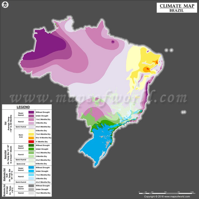
Being the fifth largest country in the world, Brazil encompasses a large area of South America. A land of biodiversity, the country has a variety of climatic zones, ranging from tropical to temperate.
Climate of Brazil
Since most of the land area of Brazil lies between the Equator and the Tropic of Capricorn, the country witnesses tropical climate for the better part of a year. The climate of Brazil can be categorized into six general climatic regions:
- Equatorial
- Semi-arid
- Tropical
- Subtropical
- Highland tropical
- Atlantic Tropical
The climate ranges from tropical in northern Brazil, near the equator, to temperate zones below the Tropic of Capricorn.
Being in the Southern Hemisphere, the seasons in Brazil are the reverse of the seasons in the Northern Hemisphere, such as Europe and the United States.
Temperature of Brazil
Renowned for the Amazon Rainforest, Brazil is often thought of as being an extremely hot and humid country, but the average temperatures vary all over Brazil.
Northeastern Brazil is the driest and one of the hottest regions in the country, experiencing periodic droughts. The central Brazil includes the Amazon, which is home to a large expanse of hot and humid forests. The rainforests surrounding the Amazon River receive up to 2,000 millimeters of rainfall per year.
The coastal regions of Brazil witness tropical climate with decent amount of rainy days in a year. Here, the seasons are more distinct than up north.
The temperate south, including the cities of Sao Paulo and Rio de Janeiro experience cool winters and hot summers, with rain throughout the year and snow at higher elevations. In some high-altitude regions, there is a bit of frost at the peak of winter season.
Rainfall in Brazil
Brazil’s rainy season is during its summer months, from December to April. The Amazon is one of the rainiest parts of the country most of the year, receiving more than 2,000 mm (78.7 inches) of rain annually. The coastal southeast experiences heavy rainfall in certain areas, as does this area’s mountain regions.
Though the national average rainfall ranges between 1,000 and 1,500 millimeters (40-60 inches) annually, the Northeast experiences a dry spell from May to November along with high temperatures, making it the driest region of Brazil.
Best Time to Visit Brazil
December to early March are the high seasons as visitors from Northern Hemisphere flock here to escape the cold and enjoy Christmas and the Rio Carnival. May through September, when the temperatures are mild and tourists are less, is another good time to visit Brazil. July through September are ideal months to pay a visit to the Amazon Rainforest or the Pantanal wetlands.
Hotel prices and other reservations are higher during Holidays which include the Carnival, Christmas, Easter, and school holidays in July.

