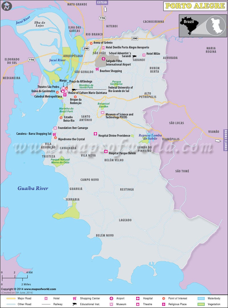
Porto Alegre is the largest city and the state capital of Rio Grande do Sul, located in the southern part of Brazil. As one of the most important cultural, political and economic centers, Porto Alegre has been offering its inhabitants best living standards since years.
Porto Alegre is situated at the junction of five rivers. Covering the banks of River Guaiba, the city was founded by the Azore migrants in 1742. The riverside position of the city has made it one of the most important alluvial ports of the world. The agricultural products such as rice, soybeans, preserved beef and leather available from the rich rural and pastoral hinterlands has led to the development of industrial and commercial centers in Brazil. Moreover, these items are successfully exported to remote countries like Japan and Africa, helping export business to prosper well on the land. Such activities offer adequate financial supports to the country’s economy.
The sub-tropical climate of Porto Alegre is characterized by high humidity. Temperature during the summers seldom rises above 32ºC, while winter temperature is pleasant in nature, normally varying between 5ºC to 25ºC. Snowfall is highly occasional in this region.
Having total population strength of 1,440,939 in 2006, the density of population in Porto Alegre is 2.905,3 persons/km2. Portuguese being is the official language of the land, both Spanish and English languages form the mediums of instruction in schools, colleges and university education levels.
The cuisine of Porto Alegre is worth mentioning, forming integral part of the national culture. Some of the dishes comprise the tasty and well-known ‘Gaucho’ Barbecue, Chimarrao Gourd, attracting a good number of tourists. Together with a large number of travel destinations like Porto Alegre City Hall, Central Public Market, Glenio Peres Square, Chalet of the XV de Novembro Plaza, Museum of Art of Rio Grande do Sul, Pintada Island, Santana Hill, Botanical Garden, Lami Biological Reserve, Farroupilha Park, etc. the city is ideal for the development of travel and tourism.
The historic monuments, soccer activities and cultural centers of Porto Alegre can be accessed easily through efficient and excellent networks of air-road-water transports. They also help worldwide travelers to participate in significant national events like Latin American Handicraft Fair, Bookfair, Ash Wednesday Carnival, Farroupilha Week of music and dance and the Expointer, a 8-day cattle-raising and agribusiness exhibition. All these jointly contribute in increasing the global popularity of Porto Alegre as a famous travel destination and offering financial back-up to the nation.

