
West Flanders is the westernmost province of the Flanders region of Belgium.West Flanders Map showing the arrondissements, Province capital, arrondissements capitals, costline, province boundary and international boundaries.
West Flanders Belgium Map
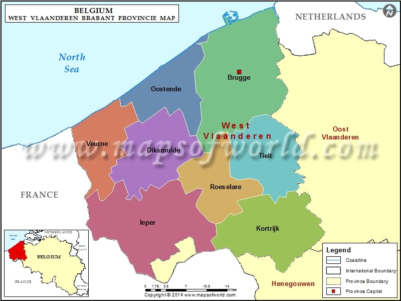
Description: Map showing the West Flanders arrondissements, province capital, arrondissements capitals and boundaries.