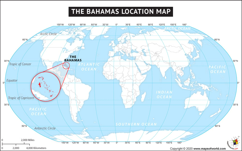
Where are the Bahamas Located?
The Bahamas are a group of islands located in the Caribbean Sea in southeastern North America.
The Bahamas are in a chain of islands that includes Cuba, Turks and Caicos, and Hispaniola, which contains the Dominican Republic and Haiti. The Bahamas are located not far from the US state of Florida. The Bahamas have an aggregate area of 13,878 square kilometers (5,358 square miles).
There are 29 islands, 2,387 islets, and 661 cays in the Bahamas. Its major islands include Grand Bahama, Eleuthera, Cat Island, San Salvador, and Andros Island. The capital of the Bahamas is Nassau, which is located on New Providence island. The population of the Bahamas is about 350,000.
The country Bahamas is on the North American continent and the latitude and longitude of the country are 24.3196° N, 76.2765° W.
The neighboring countries of the Bahamas are:
Maritime boundaries
Quick Facts About Bahamas |
| Country Name | Bahamas |
|---|---|
| Continent | North America |
| Capital and largest city | Nassau |
| Area | 13,878 km2 (5,358 sq mi ) Water (%) 28% |
| Population | 0.401 million estimate |
| Lat Long of Bahamas | 24.15 N and 76 W |
| Official Language | English |
| Calling Code | +1 242 |
| Time Zone | EST (UTC−5) Summer (DST) EDT (UTC−4) |
| The airport in the Bahamas | 41 Airports in the Bahamas |
| Neighbor countries | Cuba, Haiti, the United States, and Turks and Caicos Islands (UK) |
| Internet TLD | .bs |
| Currency | Bahamian dollar |

