
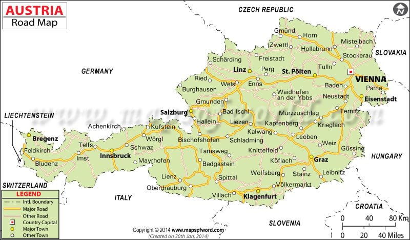
Austria road map showing the major roads, driving directions, and national highways network spread across Austria with adjoining cities. The map shows the national capital city Vienna.
This landlocked country shares its borders with the Czech Republic and Germany to the north, Slovakia and Hungary to the east, Slovenia and Italy to the south, and Switzerland and Liechtenstein to the west.