Covering an area of 3,269,000 square miles, Australia is the smallest continent in the world.
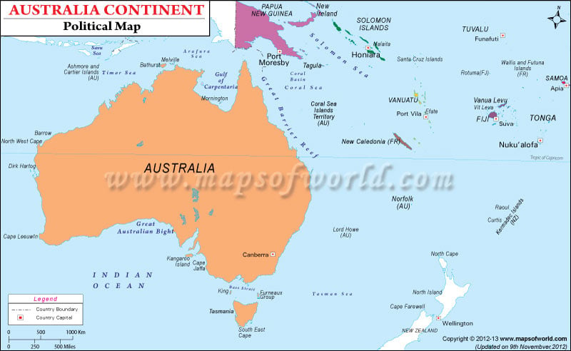
The Australia Continent Political Map shows the major cities, states and their capitals, islands and other political divisions of the continent.
The geological and geo-political information about the continent of Australia have never been accurate and hence there have been major disputes regarding the political divisions of the continent.
Generally it is considered that the Australian continent comprises the mainland of Australia and proximate islands including Tasmania, New Guinea, the Aru Islands and Raja Ampat Islands. Parts of Indonesia also make up the continent.
The continent of Australia is geo-politically termed as Oceania by the United Nations. Historicall, the region was called Australasia and it included Australia, New Zealand and sometimes Papua New Guinea. If geologically considered, New Zealand does not form part of the Australian continent.
The Commonwealth of Australia has six states – New South Wales, Queensland, South Australia, Tasmania, Victoria, and Western Australia and two major territories – the Northern Territory and the Australian Capital Territory.
Canberra, the national capital is shown clearly in the map. As the seat of the government of Australia, Canberra is the site of Parliament House, the High Court and numerous government departments and agencies.
Sydney is the largest and most populous city in Australia and the state capital of New South Wales. It is an international center for commerce, arts, fashion, culture, entertainment, music, education and tourism.
Australia is a federal parliamentary constitutional monarchy. Tony Abbot is the current Prime Minister of the country while Elizabeth II is the ruling Monarch.
| Division | Population | Area(km.²) | Area(mi.²) | Capital |
|---|---|---|---|---|
| Australian Capital Territory | 323,665 | 2,365 | 913 | Canberra |
| Jervis Bay Territory | 369 | 67 | 26 | Canberra |
| New South Wales | 6,549,177 | 801,425 | 309,432 | Sydney |
| Northern Territory | 192,898 | 1,356,170 | 523,620 | Darwin |
| Queensland | 3,904,532 | 1,736,587 | 670,500 | Brisbane |
| South Australia | 1,514,337 | 984,377 | 380,070 | Adelaide |
| Tasmania | 476,481 | 68,127 | 26,304 | Hobart |
| Victoria | 4,932,422 | 227,619 | 87,884 | Melbourne |
| Western Australia | 1,959,088 | 2,527,621 | 975,920 | Perth |
| Ashmore and Cartier Islands | 0 | 5 | 2 | Darwin |
| Coral Sea Islands Territory | 0 | 3 | 1 | Kingston |
| 11 divisions | 19,855,288 | 7,704,366 | 2,974,672 |

