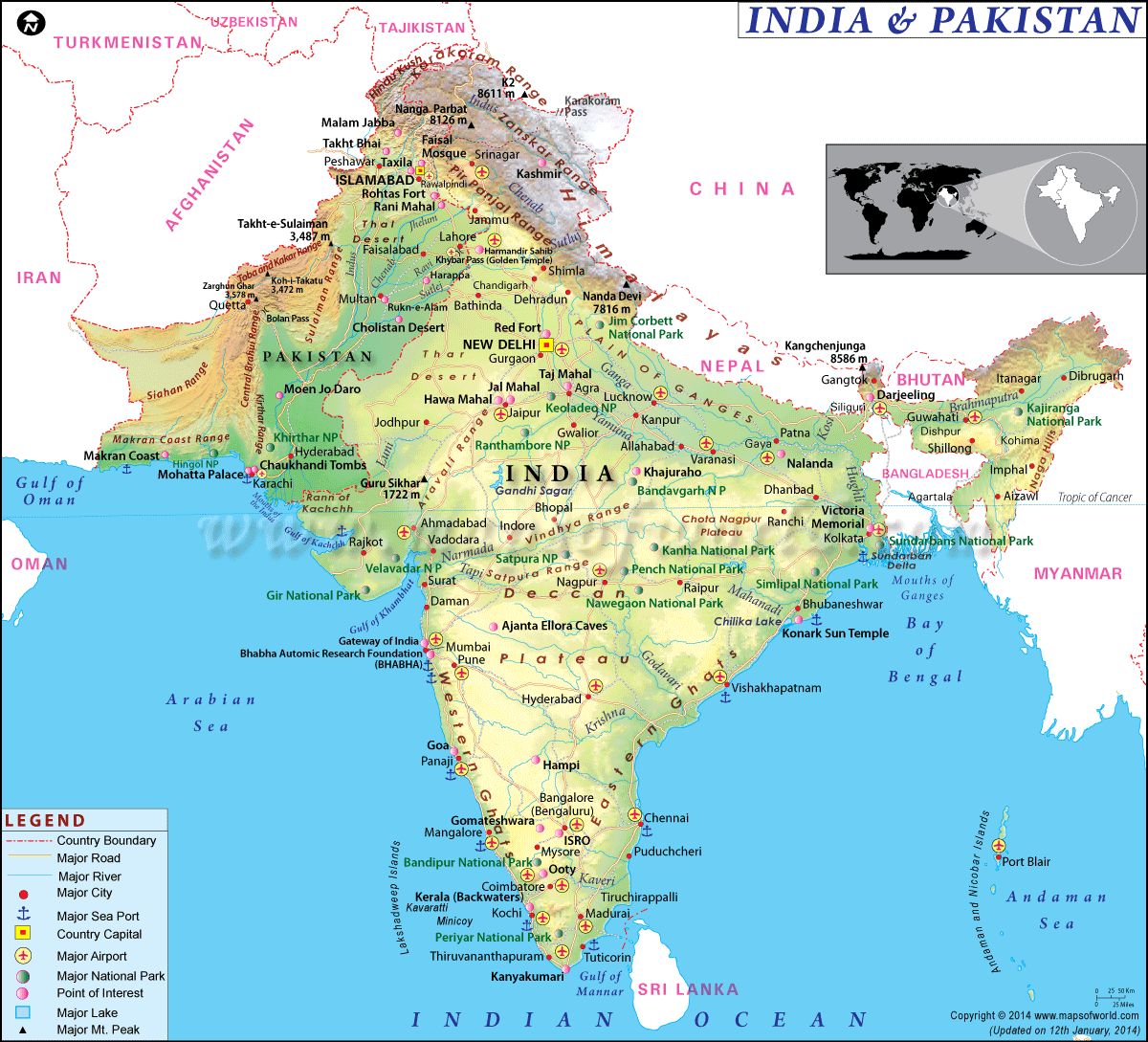
Map of India and Pakistan

Description : The Map of India and Pakistan showing the geographical location of India and Pakistan along with their capitals, international boundary, major cities and point of interest.
Radcliffe Line, which was drawn by Sir Cyril Radcliffe, demarcated the boundary between the countries of India and Pakistan. Starting from LOC, which separates Indian Kashmir, and Pakistan Occupied Kashmir, the border runs through the Indian Punjab and Pakistan Punjab. The border divides the Pakistan's Sindh province and the Indian states of Gujarat and Rajasthan.
As of 2015, the population of Pakistan stood at 199,085,847 people. Of this, Muslims form the majority comprising 96.4 percent. The minority communities include Hindus, Christians, and Sikhs. In comparison, the population of India comprises a staggering 1,251,695,584 people. The Hindu community forms around 79.8 percent of the population, while Muslims form the biggest minority and account for 14.2 percent of the population. Other significant minority communities are Sikhs, Buddhists, Christians, among others.
Agriculture forms an important sector of the economy. Contributing around 24 percent of the GDP, agriculture accounts for around half of the employed work force in the country. The textiles and apparel segment account for a majority of the country's export earnings. In 2015, Pakistan's GDP (Purchasing Power Parity) was $931 billion in comparison to $893.1 billion that was reported in 2014.
Since the onset of liberalization in 1991, the Indian economy has made rapid strides. Today, the country is one of the fastest growing economies in the world. Though nearly 50 percent of the Indian workforce is engaged in agriculture, the service sector is a significant source of economic growth. This sector accounts for around two-third of the country's output. In 2014, India's GDP (Purchasing Power Parity) was $7.421 trillion. In 2015, this increased to $7.965 trillion.
Some of the major cities of Pakistan include Islamabad, the capital of the country, Lahore, Karachi, Peshawar and Quetta. Some important Indian cities include New Delhi, the capital of the country, Mumbai, Bengaluru, Kolkata, Chennai, Ahmedabad, Hyderabad, to name a few.
Interesting Questions & Answers
| More Maps... |
|---|
| Map of Japan and South Korea | Map of South Korea and North Korea | Map of China and Japan |
| Map of Israel and Palestine | Map of Iraq and Syria |

