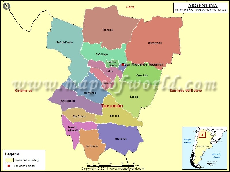
Description:Map of Tucumán province showing 17 Departments boundaries with province boundary and capital.
Facts about Tucumán Province of Argentina
|
| Country |
Argentina |
| Capital |
San Miguel de Tucumán |
| Departments |
17 |
| Municipalities and rural communes |
112 |
| Area |
22524 sq km |
| Population |
1448188 ( Census 2010 ) |
| Demonym |
tucumano |
| Time zone |
ART (UTC−3) |
| Website |
www.tucuman.gov.ar |
Departments of Tucumán Province of Argentina
|
| S.N. |
Department |
Seat |
Population |
Area (sq km) |
| 1 |
Burruyacú |
Burruyacú |
32,936 |
3,605 |
| 2 |
Capital |
San Miguel de Tucumán |
527,607 |
90 |
| 3 |
Chicligasta |
Concepción |
75,133 |
1,267 |
| 4 |
Cruz Alta |
Banda del Río Salí |
162,240 |
1,255 |
| 5 |
Famaillá |
Famaillá |
30,951 |
427 |
| 6 |
Graneros |
Graneros |
13,063 |
1,678 |
| 7 |
Juan Bautista Alberdi |
Juan Bautista Alberdi |
28,206 |
730 |
| 8 |
La Cocha |
La Cocha |
17,683 |
917 |
| 9 |
Leales |
Bella Vista |
51,090 |
2,027 |
| 10 |
Lules |
Lules |
57,235 |
540 |
| 11 |
Monteros |
Monteros |
58,442 |
1,169 |
| 12 |
Rio Chico |
Aguilares |
52,925 |
585 |
| 13 |
Simoca |
Simoca |
29,932 |
1,261 |
| 14 |
Tafí del Valle |
Tafí del Valle |
13,883 |
2,741 |
| 15 |
Tafí Viejo |
Tafí Viejo |
108,017 |
1,210 |
| 16 |
Trancas |
Trancas |
15,473 |
2,862 |
| 17 |
Yerba Buena |
Yerba Buena |
63,707 |
160 |

