Afghanistan is a landlocked country in Central Asia covering an area of about 251,772 square miles.
The estimated population of the country is 40.7 million. Persian or Dari and Pashto are the official languages of Afghanistan. Other languages also spoken in the country are Uzbek, Turkmen, Balochi, Pashayi, and Nuristani.
Afghanistan is a Muslim state; over 99% of the population is Muslim. The remaining 1% of the population comprises Sikhs, Hindus, and Jews.
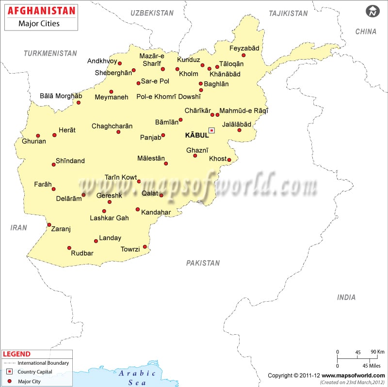
The cities map of Afghanistan shows the national capital, major cities, and the administrative divisions of the state. The map also clearly demarcates the provincial and international boundaries of the country. Afghanistan is bordered by Pakistan, Iran, Turkmenistan, Uzbekistan, Tajikistan, and China. Kabul, the capital city, is located in eastern Afghanistan and is an important economic and cultural center.
The major cities of Afghanistan are Kandahar, Herat, Lashkar Gah, Baghlan, Gurian, Jalalabad, Mazari Sharif, and Ghazni.
Afghanistan is an Islamic republic and is currently led by the Mohammad Hasan Akhund administration. Mohammad Hasan Akhund is the current Prime Minister of Afghanistan.
Afghani, denoted by the code AFN, is the official currency of Afghanistan. It is issued by Da Afghanistan Bank. Major industries in the country are furniture, shoes, fertilizers, apparel, food products, natural gas, coal, and copper. Pakistan, India, Russia, Germany, Tajikistan, and United States are the chief trading partners of Afghanistan. The country exports opium, fruits, nuts, wool, cotton, and precious and semi-precious stones, while the major imports include capital goods, food, textiles, and other consumer goods.
List of Major cities in Afghanistan |
|---|
|
|

