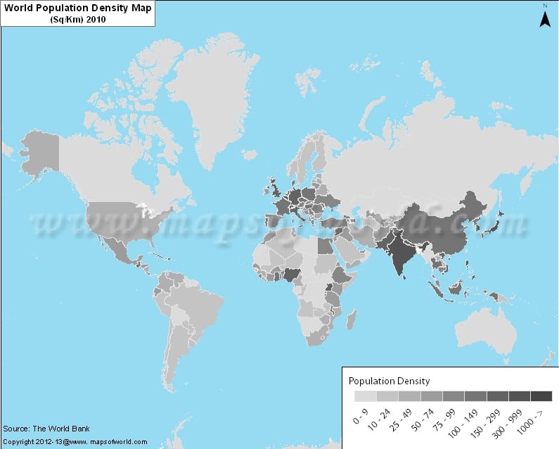
The range of population density has been classified into certain intervals and shown through respective colors.With the help of population map, students and researchers can understand the overall distributing of population density in the world.
The range of population density starts with white polygon, depicting 0 to 5 person per sq km. and ends with deep red polygon which shows 1000 and above person per sq. km. Canada, Australia, Mongolia, Russia and few countries of north, north west, and central Africa have very low population density.
The medium population density countries are USA, Central America, South America, countries of eastern and southern Africa, north Europe, Saudi Arabia (Asia) etc. Remaining part of the world like Western Europe, rest of Asia etc. are the countries having the highest population density regions of the world.


