- Virginia Counties - Virginia County Map, Map of Virginia Counties
- Major Cities of Virginia - Portsmouth, Richmond VA, Salem, Bedford, Bristol
- Neighbouring States - Kentucky, West Virginia, Maryland, North Carolina, Tennessee
- Regional Maps - Map of USA
- Other Virginia Maps - Virginia Map, Virginia Physical Map, Virginia Airports Map, Virginia Lat Long Map, Virginia Zip Code Map, Virginia Area Code Map, Virginia National Parks Map
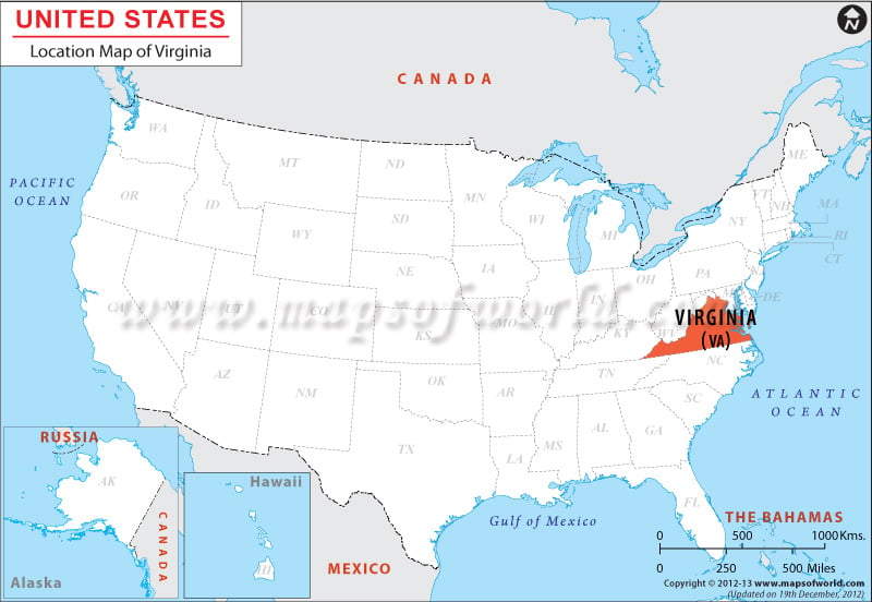
The Virginia Location Map clearly indicates the exact geographical situation of the state of Virginia on the map of U.S.
The State of Virginia is situated on the eastern coast of the United States of America, within the coordinates 37.5° N, 79.0° W. The mean elevation of the state is 950 feet or 290 meters. Virginia is edged by West Virginia to the northwest side, by District of Columbia and Maryland to the east and north, by the Atlantic Ocean to the east, by Tennessee and North Carolina to the south, and by Kentucky to the west. The state of VA covers a total area of 42,774.2 sq miles or 110,784.67 km2, which includes 3,180.13 sq miles (8,236.5 km2) of water, making it the 35th biggest state in terms of area.
Because of a distinctive feature of the original charter of Virginia, its border with Washington, D.C. and Maryland does not stretch beyond the low-tide level of the southern coast of the Potomac River (different from several edges that divide a river in the central portion). The southern boundary is specified as 36°30′ parallel north. However, surveyor mistake resulted in variations to the extent of three arc minutes.
The highest point of the State of Virginia is Mount Rogers, which is located at an elevation of 5,729 feet and the lowest point is Atlantic Ocean (altitude 0 feet).
Several rivers and lakes flow through the state. Potomac River, James River, Shenandoah River and Rappahannock River are some of the important rivers in Virginia.
John W. Flannagan Reservoir, John H. Kerr Reservoir, Atlantic Intracoastal Waterway, Pound Lake, Gathright Dam (Lake Moomaw), and Philpott Lake are some of the notable lakes and water bodies of the state.
Facts About Virginia |
|---|
| State Name | Virginia |
|---|---|
| Country | USA |
| Continent | North America |
| Capital | Richmond |
| Largest city | Virginia Beach |
| Area | 42,774.2 sq mi (110,785.67 km2) |
| Population | 8,326,289 (2014 est) |
| Lat Long | 37° 30′ 0″ N, 79° 0′ 0″ W |
| Official Language | English |
| Calling Code | 00 1 757 X |
| Time Zone | Eastern: UTC −5/−4 |
| Airport | 9- Airports Commercial service |
| Neighbour State | Kentucky, Maryland, North Carolina, Tennessee, West Virginia |
| Internet TLD | |
| Currency | United States Dollar (USD) |
 Wall Maps