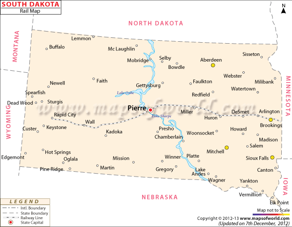
The rail routes of the state are prominently indicated in the South Dakota Railway Map. South Dakota had 3,070 kilometer of well laid railway tracks in the year of 2000.
The railway lines of South Dakota can be classified into three categories of the Core System, Local Option Lines and Main Line. The State of South Dakota operates four local option lines. Two local option lines are operated by the D and I Railroad that comfortably join Canton and Elk Point, and also run in-between Hawarden and Beresford. The Dakota Southern Railway links the two cities of Kadoka and Mitchell. Some of the Local Option Lines of South Dakota are non-functional.
The 480 miles long main line of South Dakota connects Ortonville, Aberdeen and Terry. The Core Railway System was sold by the state to BNSF in November, 2005.
The railway lines of South Dakota transfer freight goods from one place to another. The South Dakota State Map points out the railway lines of the state that helps in easy connectivity of the important cities. The main cities of Pierre, Rapid City, Huron, Miller, DeSmet and Arlington of South Dakota are easily accessible by the railway lines of the state.
 Wall Maps